
ESC - Spain -
Mulhacén
, 3479m - Info | Trip Report | VR TourIntroduction :
To many people's surprise, Spain's highest mainland peak lies not in the Pyrenees of northern Spain, but in the Sierra Nevada mountains near Spain's southern coasts. Here the Sierra Nevada National Park was formed in 1955. The park has an area of 86.208 hectares and includes more than 40 towns in the provinces of Granada and Almería. There, more than a dozen peaks over 3000 metres break the skyline, including the two highest on the Spanish mainland, Mulhacén (3482 metres) and Veleta (3398 metres). A traverse of the Sierra Nevada that includes these peaks is a fine objective, although Mulhacén can be climbed in a day from a high starting point such as the road that climbs to the summit of Veleta.
It is worth noting that the effects of altitude can start at 2500m, so some aclimitaisation may be considered. In winter the northern slopes of Veleta become a ski run. Don't let this fool you, an undertaking to summit Mulhacén in winter can be a serious proposition especially if the weather turns bad. Deaths have been recorded.
And finally, a little history; Mulhacén is named after Abu l-Hasan Ali, known as Muley Hacén in Spanish, the penultimate Muslim King of Granada in the 15th century who, according to legend, was buried on the summit of the mountain.
Getting there and away :
I took a Go flight to Madrid and an overnight train to Granada. This was cheaper than taking alternative budget flights to the Spanish southern cities. Check current prices. From the rail station at Granada take a bus to the city's coach station from where there are buses to Capileria and other villages in Las Alpujarras.
By Rail
Visit the website of the national railway network of Spain (RENFE), www.renfe.es for timetables and fares.
By Car
From Granada, the south side is reached by following the N-323 (Granada-Motril) as far as the crossroad to Lanjaron (44 km). The Park is reached after passing through this village, continuing to Alpujarras. From this road several secondary roads lead to other little villages sited in the south face of the National Park.
Also from Granada the Park is reached by following the road as far as "Sol y Nieve", the Sierra Nevada's winter sports resort. This road continues past the resort as far as the peak of Veleta. A Reception Centre is located in "El Dornajo" (km 23).
The north side is reached by following the dual carriageway A-92 as far as Guadix and Tabernas (Almería). From this road several secondary roads lead to other places sited in the north face of the National Park.
Accommodation :
Because I was travelling just out of season, I did not bother booking accommodation ahead of leaving the UK. In Capileria there are a number of small hostels and I stayed in the first I found. Once on the hill the refugios are un-manned and very basic. You will need to carry with you a sleeping bag, insulating mat, stove and food. Camping in the Sierra Nevada is permitted though officially permission should be sought from the park authorities before hand.

|
| The Refugio Pillavientos. |
You can find accommodation at www.andalucia.com.
Maps and Books :
| OpenStreetMaps shows the ascent routes. |
 Lonely Planet's Trekking in Spain 2nd edition appeared on the bookshop shelves shortly after my return. It was much updated from the 1sst edition and explained that the authorities had chosen to demolish the manned mountain huts over 3000m as part of an environmental project. A 3rd edition was published in 2003.
 Cartografia Militar de Espana 1:50,000 L Series Maps Güéjar-Sierra 20-42 and Lanjaron 20-43 cover the area required, and I used these on my trek. They were very outdated and inaccurate.
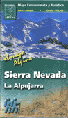
However Editorial Alpina have since released a 1:40,000 map of the "Sierra Nevada - La Alpujarra" which has contours at 20m, the locations of footpaths and huts. It comes with a booklet in English. ISBN 848090075X.
Useful Links :
The Official website of the Spanish Tourist Board.
You can read the latest UK government travel advise to Spain at https://www.gov.uk/foreign-travel-advice/spain.
The Trek Sierra Nevada website has all the other information you'll need.
For a weather forecast, check www.mountain-forecast.com.