ESC -
Germany - Zugspitze
, 2962m - Info | Trip ReportIt was the last day of May 2002, the sun was shinning, and back home in England the people were preparing to celebrate the Queen's Golden Jubilee with a two-day bank holiday. I on the other hand had chosen to take advantage of the two-day freebie and caught an early morning flight from Stansted to Frankfurt-Hann. A six hour drive on the German autobahns in a rented Renault Clio delivered me to Garmisch-Partenkirchen near the Austrian boarder, and more importantly, at the foot of the Wettersteignebirge massive, home of the Zugspitze, at 2962m, Germany's highest mountain, and my target for the weekend. I could not be helped but be awestruck by the scenery as I approached.
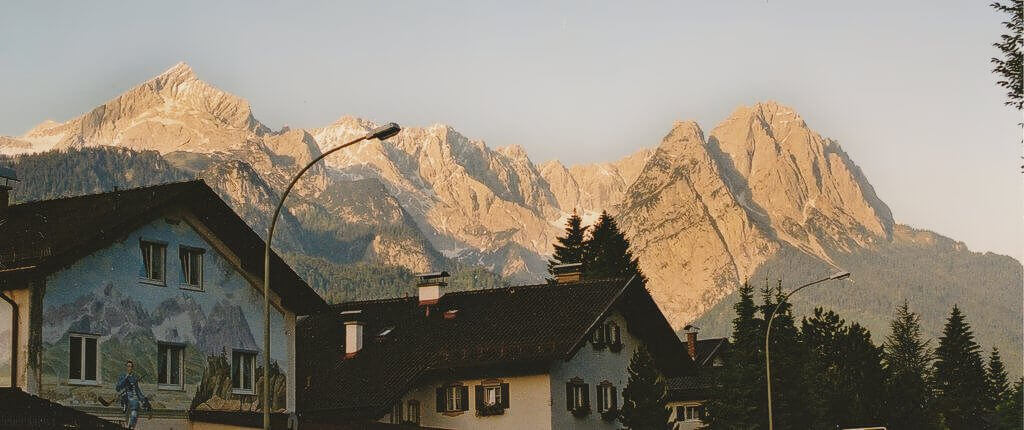
|
| View from Garmisch of the Wetterstein Massive. Alpspitze (2628m) to the left, the Zugspitze is hiden by the ridges on the right. |
First stop the tourist information office for two pieces of information; the condition of the summit route, and the location of a cheap room for the night. The middle-aged lady behind the desk could not have been more helpful. She phoned the guardian at the Knorrhutte, and on confirming that he spoke English, passed over the receiver so that I could confirm specifics myself. The guardian was also delightfully helpful, but his news was not good; the path to the summit was closed, too much snow.
The room found for me by the tourist office was a bargain. For twenty-six Euros I had a single room with on-suite facilities and cable TV, in a privately run, family hotel. But what was I to do tomorrow? Push on to the Knorrhutte and judge the conditions for myself and hope for a miracle, or chose to exercise my demons on lower mountains?
The Knorrhutte won, I took an evening walk to the Olympic Ski Stadium where I intended to park the car the following day. Built prior to the Second World War, the stadium was this weekend the venue for a mountain bike festival. I inquired at what I took to be the ticket office if there was a parking fee and if overnight parking was permitted. The answer to both these questions were favourable. I returned to Garmisch via Partenkirchen and found myself a suitable restaurant for dinner, enjoying my food, a beer, and the wonderful paintings that daubed the walls of the buildings such is not seen in the UK outside Northern Ireland. These however were no para-military icons but scenes taken, I assume, from local history and myth. Contented with my meal, I strolled the short distance back to my hotel where I re-arranged my backpack and travel bag for the following day. I went to bed early with my alarm set for six am.
By seven the following morning I was tracing a track up to the Partnach Alm through a mixture of forest and alpine pasture. Here I contoured the hillside at just below one thousand metres. The day was as perfect as anyone could have wished; sunshine and brilliant blue skies, the weather forecast predicted it would last.
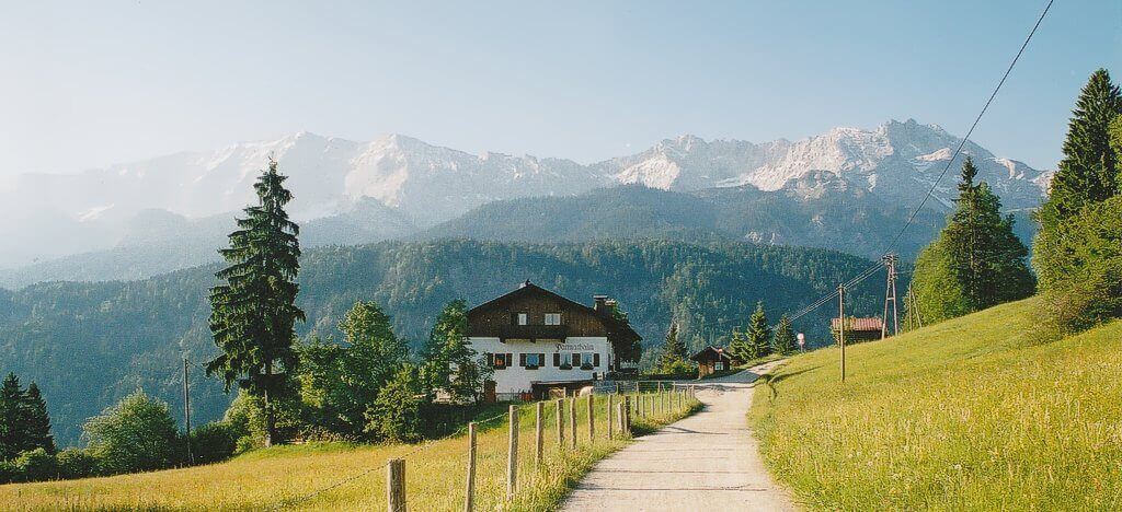
|
| Approaching the Partnach Alm. |
At a junction of paths, I came across another loan walker photographing the perfect pyramid of a summit rising above the trees in front of us. His English was good; we discussed possible identities of the peek and took a compass bearing to confirm it. The Alpspitze (2628m) is a popular via-ferrata destination, given time I would have liked to add this to my schedule. Perhaps another day.
Thomas and I talked for a while. He had made an attempt on the Zugspitze from the northern side the previous day and had been forced to turn back, the route beyond the Neustadter Hutte made impassable by the snow. Today he was walking as far as the Bock Hutte on the bank of the Reintal River before heading back to the campsite at Grainau, a few kilometres west of Garmisch.
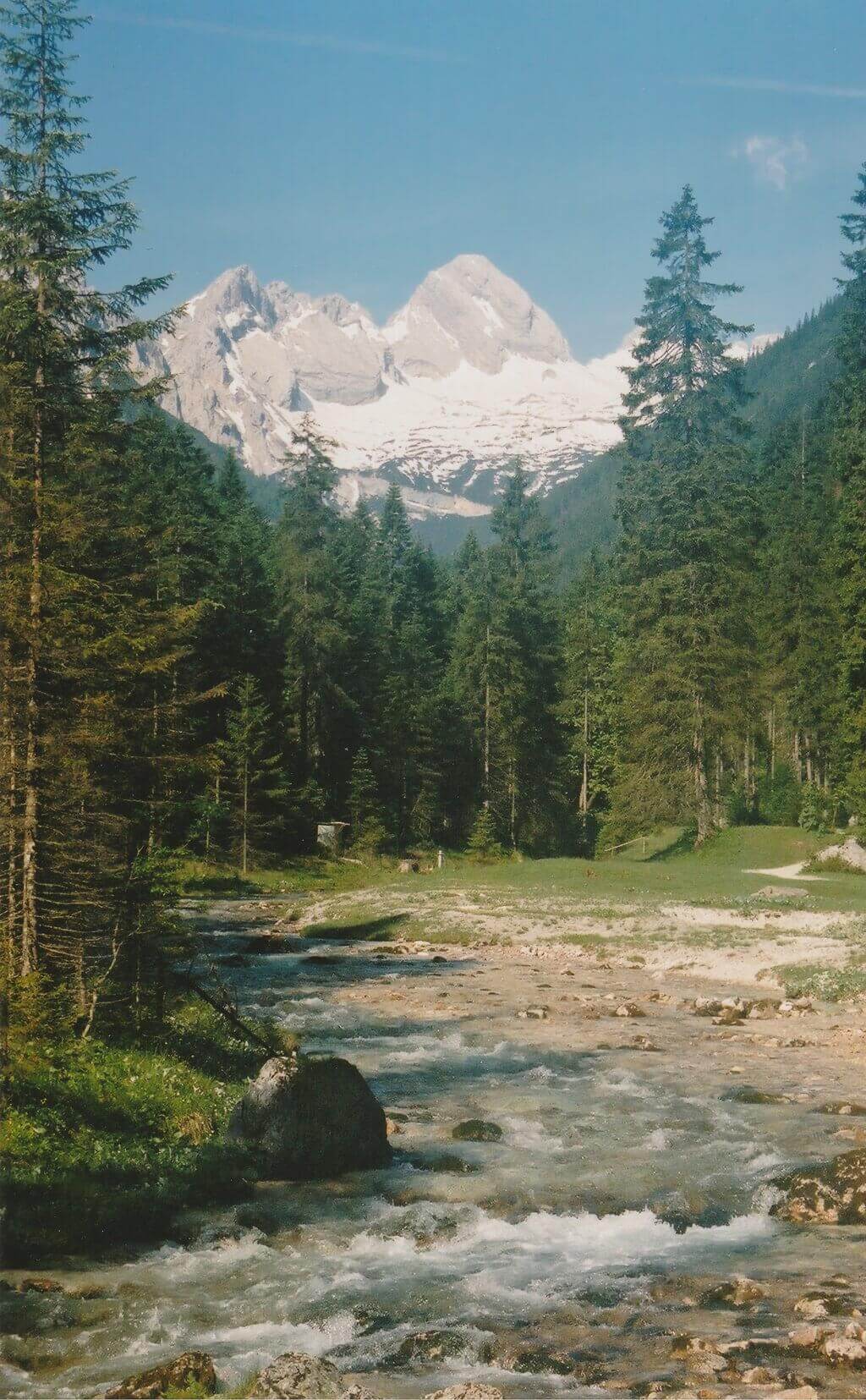
|
| The Reintal Valley. |
During our walk to the Bock Hutte I told my newfound companion of my planned attempt on the Zugspitze from the south and my hope that conditions would be more favourable. By the time we reached the hut at the head of the Reintal valley Thomas had warmed to the idea enough to accompany me at least as far as the Knorrhutte where we would review the situation in the morning.
The path along side the Reintal River was deservedly busy with walkers and cyclists. I say deservedly because it was beautiful; cool rushing waters, grassy banks, coniferous forest, and high above, the great bare rock walls of the surrounding mountains, snow on ledges. Another apparent virtue was the bar and sun loungers at the Angerhutte. Fathers drank beer and children played with toy water wheels in the shallow waters. We did not stop.
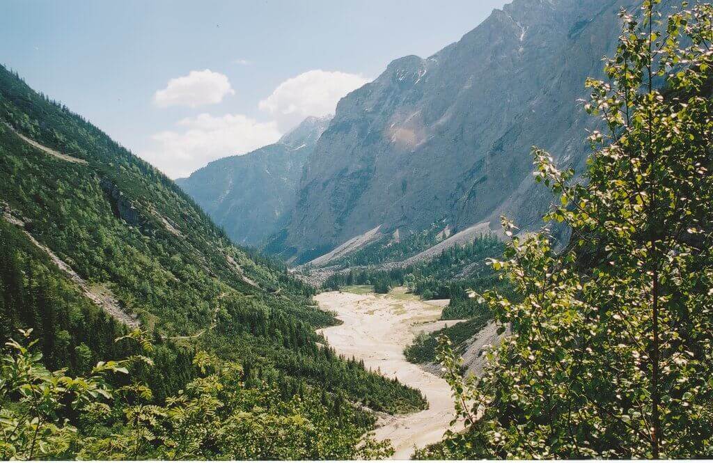
|
| Looking back down upon the Reintal Valley. |
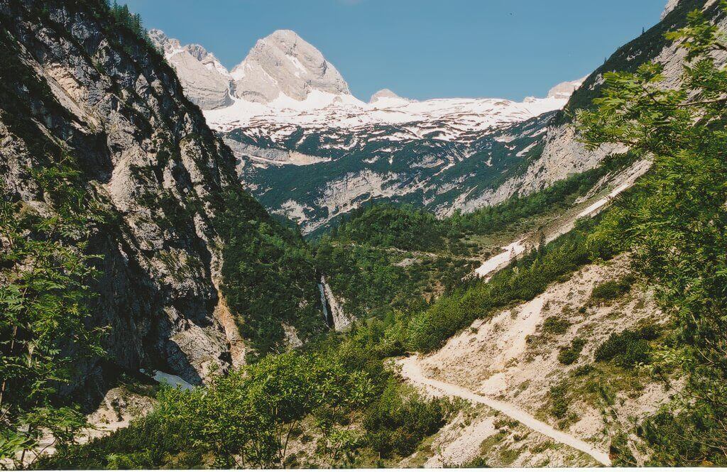
|
| Looking up at the Platt. |
Thus far the walking had been easy, but beyond the Angerhutte the path climbed near seven hundred metres in two kilometres, the same height I had climbed thus far in fourteen kilometres. We rested many times, arriving on the sunny terrace of the Knorrhutte early in the afternoon. It was then that knowledge of the local language came into its own. I could, and still cannot, speak more than a few words of German, but Thomas, being German, did not have that disadvantage. He was able to over hear conversations and canvas opinion. Most of those he spoke to had taken a cable car to the summit that morning, and then descended on a second to a station on the Platt three kilometres west and five hundred metres above us. From there they had walked down across the snowfield whose frozen rim just encompassed the hut. But one seasoned soul spoke of his descent from the summit itself. Yes the route was covered in snow, many of the wire rope protection lay buried, but an ascent was possible. Our spirits rose.
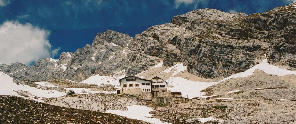
|
| Looking up at the Knorrhutte. |
We ate a late lunch of hot stew and considered our next move. It was still early, and the thought of trekking on up to the next accommodation tempted us. But enquires with the Knorrhutte's guardian stopped this; the hut (or hotel, I never discovered which) at Schneeferner scharte would be closed. There was no choice, tonight would be spent at the Knorrhutte, but an early start would see us to the summit in good time. This left us an afternoon and evening to do, well nothing. This did not seem an attractive proposition, so when Martin introduced himself and suggested a light weight attempt on the nearby Höllentalspiten, a 2743 metre peak in the ridge above us, we jumped at the chance.
In hindsight this was a step too far. We never did make it to the summit of the Höllentalspiten, nor as it happens, the main ridge. In part this was due to an unprotected snow slope, but time and fatigue were also significant factors. We would have done better by resting and reserving our energy for tomorrow's push.
On our return to the hut, we ate, drunk and rested. That night I hardly slept; visits to the stinking toilet being unwelcome but not infrequent. Was it something in the German beer, or were my nerves more to blame? I don't know. But come five or six when it was time to leave I felt little better for the passing of the hours, and struggled to eat and drink my share of breakfast.
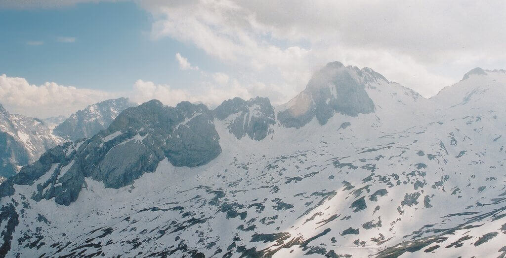
|
| Looking down upon the SchneefernerScharte. |
Progress that morning was slow, our ascent to the proximity of the Schneeferner scharte taking far longer than ever we anticipated, but perhaps two hours was not unreasonable given the terrain and changing visibility as the clouds swept over the route. A step snow slope now stood between us and the first section of protected scramble. We eyed it cautiously; weary of its soft texture and the possibility of an avalanche. I don't think either of us was keen, but the job had to be done. We pushed on and were glad to step onto naked rock when at last we came to it. That first section of via-ferrata, or Kletterstieg, to give it its German name, was bliss. Indeed the route we were taking is the easiest, in summer it is the walker's choice of descent. Today was a different story. The broad ledge soon gave way to exposed scrambles, and snow covered scree slopes where the way ahead had to be deduced through brakes in the cloud. Someone familiar with Mt. Snowdon in North Wales might compare this to scrambling up the side then along a snow covered Crib Goch. It was frightening but brilliant, and when we clambered up the steps onto the concrete viewing decks those tourists who had taken the cable car greeted us like minor heroes.
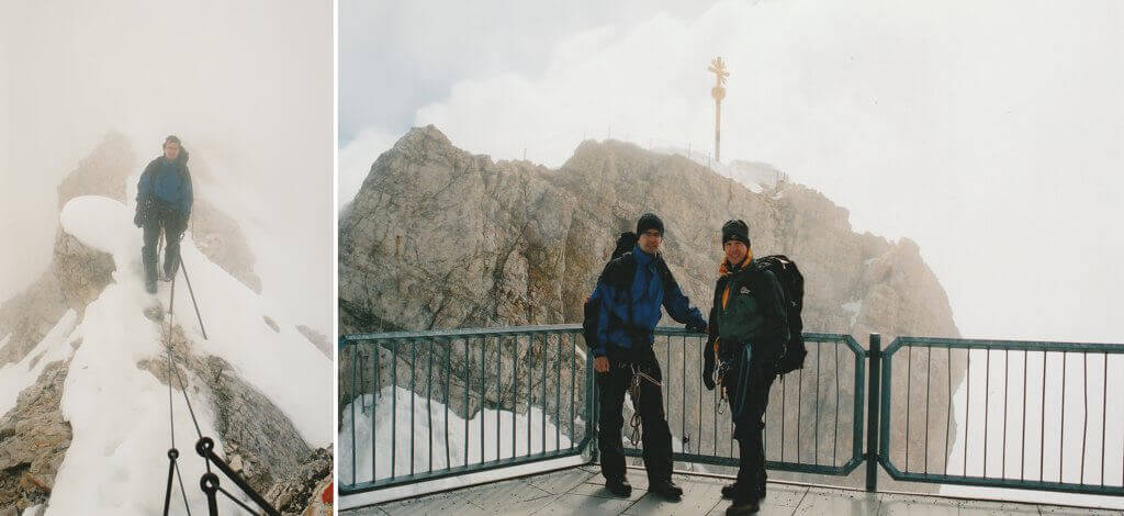
|
| Traversing the narrow ridge to the summit station, and the viewing platform. |
Throughout the morning's ascent we had been alone, passing only three or four who were making their way down. The jostle of this sightseer's Mecca seemed a little unreal. We deserved better than this; we deserved a mountain without the tourist, the concrete platforms and buildings, without the closed gate and sign that forbade us entry to the final ten or so metres of snow covered rocks to the summit cross. But we had come too far to be halted by such artificial obstacles that were, we decided, meant for the gondola taking public. We clambered under the barrier, skirted the restaurant terrace and stepped out once again onto the mountain. The summit was ours and ours alone. We were ecstatic.
Now, if I came across a little high and mighty in that last paragraph I must apologise quickly, if only to halt the calls of hypocrite. For now comes the time to tell you that we caught the cable car back down to the south side of the mountain, studying the route of our ascent as the clouds cleared. There were good reasons for this choice of transport. Thomas had a train he needed to catch if he was to get back to work the following day. A solo descent of the steep slushy slopes did not appeal and I had made a promise to my wife and parents not to do anything stupid. Sound as these reasons were, they did little to reduce my guilt.
At the Zugspitzbahn my companion was to take a train through the heart of the mountain back down to the valley. So we said our farewells and swapped e-mail addresses. I re-traced the morning's route across the north side of the Platt to the Knorrhutte, where after a brief rest and the begging of sun cream for a sunburnt neck and face, I continued in a southerly direction over the thawing snow, through which I frequently sunk, in a traverse of the Plattsteig to the Gatterl, a col on the Austrian border. I was tired, and horrified whenever the path rose upwards, having fooled myself that from now on it was all down hill. But within a kilometre the long decent to Ehrwald began, a easy walk through alpine pasture beneath the towering, hulks of the Mieminger Mountains to the south and the Wettersteingebirge from which I had just come.

|
| Traversing the narrow ridge to the summit station, and the viewing platform. |
A dust track linked various chalets and restaurants along the valley floor. The mountain path descending from the Gatterl soon joined this, but not quite where my map suggested. It was not a problem, yet I was in a hurry, eager to return to the stadium at Garmisch to be assured that the Renault Clio was still safely parked. So I passed the enticements of the Ehrwalder Alm with its forecourt decked with benches, tables, shade offering parasols, and cool thirst quenching beers, stopping only to study my map.
