Mountains of Croatia -

Istria

- HPO 10 |

Opatijska planinarska obilaznica


These tours allow you will be able to hike the Opatijska planinarska obilaznica (Opatija Mountain Bypass), a circular hiking path that explores the Adriatic facing peaks of the Učka and the Ćićarija massives.

The 45 Km route was created and is maintained by P.D. "Opatija" (Mountaineering Club Opatija) who produce a guidebook come logbook in which the stamps of 15 control points (KT) can be printed. Taking an estimated 15.5 hours to walk, the club suggests splitting the journey over two days, perhaps staying overnight in the Poklon mountain hut (open at weekends and public holidays). Indeed it doesn't really matter if the route is split further and walked in either direction. But beware, whilst some sections of the OPO follow roads and forestry tracks, there are other stretches without a real path, particularly between Majkovac and Zvoncev vrh. Here one must look ahead to the next waymarking. In the Banine canyon other dangers may be faced, for in places the stream has to be crossed and high water levels may make the route impassable.

The control points can be found at ...
  1. Opatija, on the path to Veprinac (197 m)
  2. Veprinac, St Mark's Church (517 m)
  3. Orjak (706 m)
  4. Majkovac (853 m)
  5. Zvončev Vrh (972 m)
  6. Budišinac (948 m)
  7. Lovačka kuća Brdo (825 m)
  8. Brložnik (1093 m)
  9. Orlove Stijene (1072 m)
  10. Crkveni Vrh (1101 m)
  11. Planinarski dom Poklon (922 m)
  12. Vojak (1401 m)
  13. Slap Rečina (637 m)
  14. Pećnik (641 m)
  15. Poljane, on the path to Opatija (189 m)

Let's Go:


Float cursor over picture button below to view start location (allowing time for Google Map to update) then click to start tour in a new window.
Resume Previous Tour

Please wait for Google Map to load here.
Opatijska planinarska obilaznica
Start from Opatija.
Start from KT 1 above Opatija.
Start from KT 2 Veprinac.
Start from KT 3 Orjak.
Start from KT 4 Majkovac.
Start from KT 5 Zvončev Vrh.
Start from KT 6 Budišinac.
KT 7 Lovačka kuća Brdo.
Start from KT 8 Orlove Stijene.
Start from KT 9 Brložnik .
Start from KT 10 Crkveni Vrh.
Start from KT 11 Pl. dom Poklon.
Start from KT 12 Vojak.
Start from KT 13 Slap Rečina.
Start from KT 14 Pećnik.
Start from KT 15 Poljane.

Key:

Yellow line with red edge indicates route of OPP
Route of OPP
White line with red edge indicates other VR Routes
Other VR Routes

The Route:


Opatija to KT 1 - on the path to Veprinac
Distance1.8 Km
Total Ascent200 m
Total Descent~ 0 m

Opatija's Walk of Fame, Croatia.
VR Logo Opatija's Walk of Fame.

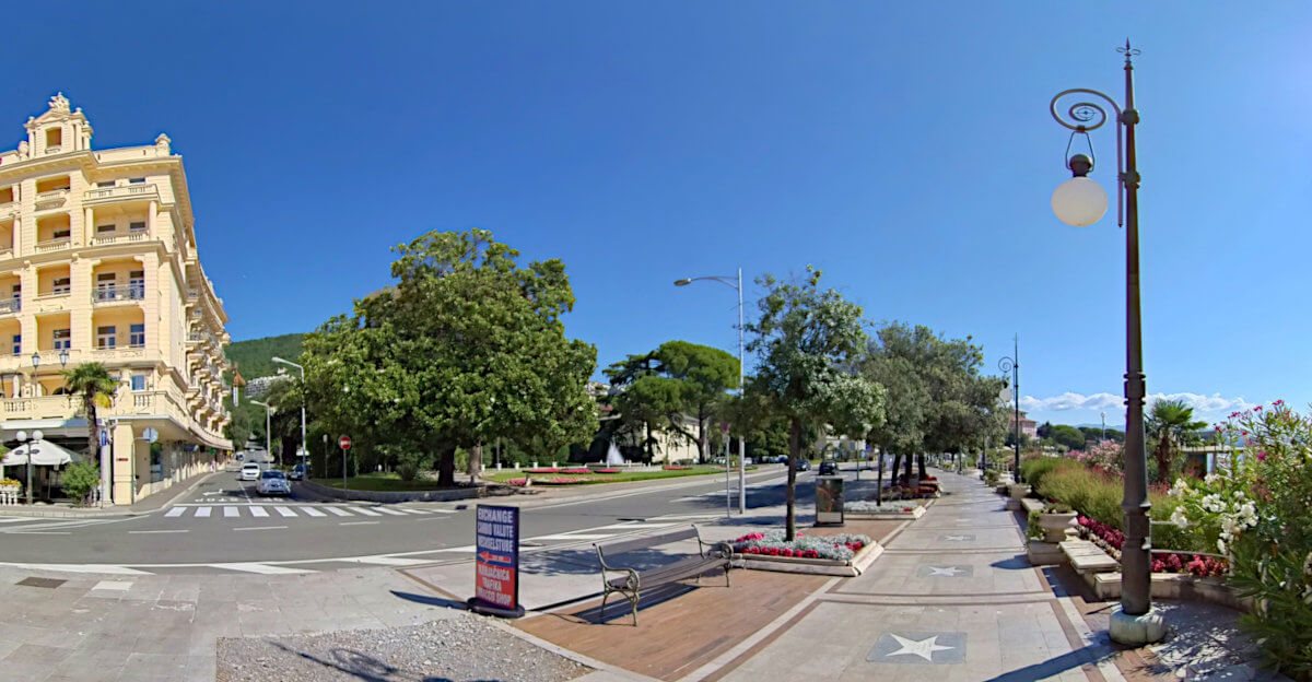
We will begin our hike in Opatija amongst stars in the Walk of Fame in front of the Grand Hotel Palace. Each star represents those who have contributed to the worldwide promotion of Croatia, and include the likes of the scientist Nikola Tesla and the tenis player Goran Ivanišević.

From the seafront the Opatijska planinarska obilaznica heads inland, past the bus station on the right, and up steps adjacent to a childrens play area, and through a landscaped park, under the Nova cesta (New Road) and along the right bank of the Slatina stream. On reaching a road, a short diversion leads to Izvor Vrutki ( Spring Well). Here an underground watercourse emerges through several fissures in the limestone, predominantly to fill a basin carved in the stone before filling another pool and flowing seaward. The women of the area once used the spring to wash clothes.

Having visited the spring, return to the road and follow it as it turns southward, after about 0.4 km take the turn to the right and climb more steeply. Pass the guest house and take the steps up into the forest. Here the path turns south and begins to zig zag. At a picnic table about an hour after you left the seafront, look for the OPO marker and stamp on the uphill side of the path.

KT 1 to KT 2 - St Mark's Church, Veprinac (516m)
Distance2.4 Km
Total Ascent300 m
Total Descent~ 0 m

Continue along the path as it zig-zags upwards from KT 1, making sure to follow the main path as it turns northwards before joining a dirt track and then the surfaced Kolavići Ulica where new villa are being (or by the time you read this, have been built). The Kolavići Ulica soon reaches a complex junction with the B8 / E751 highway, at the time of writing a main transport artery, but with the drilling of a second tube of the Učka tunnel, will be widened to at least dual carriageway status. Follow the Kolavići Ulica under the B8 / E751 highway, taking the Vas Ulica, the first road on your left shortly afterwards.

Vas Ulica starts by heading south east, bends to the right to head south, and again to head westward. Here it ends, take the path into the forest and keep climbing.

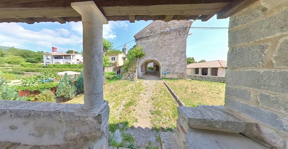
Having skirted a few homes on its initial section, the path, well cobbled in places, climbs through shady forest, often zig-zagging, before straightening and emerging amongst more homes on the southern slopes of Veprinac. At the first road junction, head up hill, and into the town's ancient gatehouse. Here it is worth a few minutes to explore the Kapeloca sv. Ana (Saint Ana's Chapel) to the left, before climbing the stairs to Crkva sv. Marko (St Mark's Church) that crowns the hill top. The control token is a metal stamp cemented into the outer wall of the church just as the track begins to descend northwards to the cemetery

Veprinac and its gatehouse from the covered porch of Saint Ana's Chapel.
VR Logo Veprinac and its gatehouse from the covered porch of Saint Ana's Chapel.

KT 2 to KT 3 - The summit of Orjak (706m)
Distance3.2 Km
Total Ascent260 m
Total Descent70 m

Veprinac can be reached from Opatija by the number 34 bus. This will drop off alongside open air sports courts from which it is a short up hill walk to join the OPO at St. Mark's Church and KT 2. Those with their own vehicles can park below the church in a spacoius parking area above the modern day cemetery.

Having hiked to Veprinac, and stamped your log book outside the church, the well marked Opatijska planinarska obilaznica heads north westward into the woods, downhill alongside the western wall of Groblje Veprinac (Veprinac Cemetery) to join the road that climbs from Pobri and Matulji. Turn left on the road and after around 80 m you'll reach a junction, take the road on the right signposted Vedež and Zagrad.

Those who have hiked the trail to Veprinac may wish to make a small deviation to the mini-market or cafe near the bus stop for refreshments then follow the road towards Pobri and Matulji thus re-joining the OPO at the junction above.

Continue on the road through Zagrad, passing the public water tap after about 8 minutes, on and through Vedež. Take note of the path signposted Majkovac, heading westward and uphill into the forest (30 minutes from the junction), you'll be retracing your steps here later. Pass the war memorial on your left and shortly after, where the road swings round in a sharp up hill bend, take the path into the forest. At the col separating Beljač (784 m) and Orjak (706 m) the trail overlaps, momentarily, that of the Lisinski put, and thus there are a number of junctions. Each junction is well signposted, just follow their directions to KT 3 on the summit of Orjak (15 to 20 minutes from the road). The best views can be obtained by continuing a little further on from the summit.

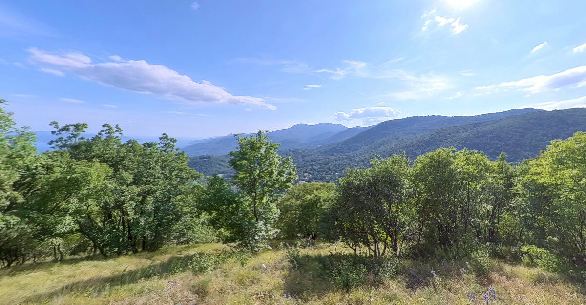
View southward towards Učka from the Opatijska planinarska obilaznica on Orjak.
VR Logo View southward towards Učka from the Opatijska planinarska obilaznica on Orjak.

KT 3 to KT 4 Summit of Majkovac (853 m)
Distance2.2 Km
Total Ascent250 m
Total Descent110 m

Descend Orjak the way you came, retracing your steps to the road and past the war memorial to the previously mentioned juncton and forest path signposted Majkovac. From here it is an hours up hill walk to the said summit, following a path that gently climb through the forest winding a meandering course as it climbs the 260 m over 1.6 Km.

The final approach on the ascent of Majkovac.
VR Logo The final approach on the ascent of Majkovac.

KT 4 to KT 5 Summit of Zvončev Vrh (972 m)
Distance2.3 Km
Total Ascent180 m
Total Descent25 m

From the viewpoint at KT 4, follow the path through the corridor of meadows in a roughly north westerly direction and downhill into the forest. There are a number of junction where the red a white way-markings make navigation easy.

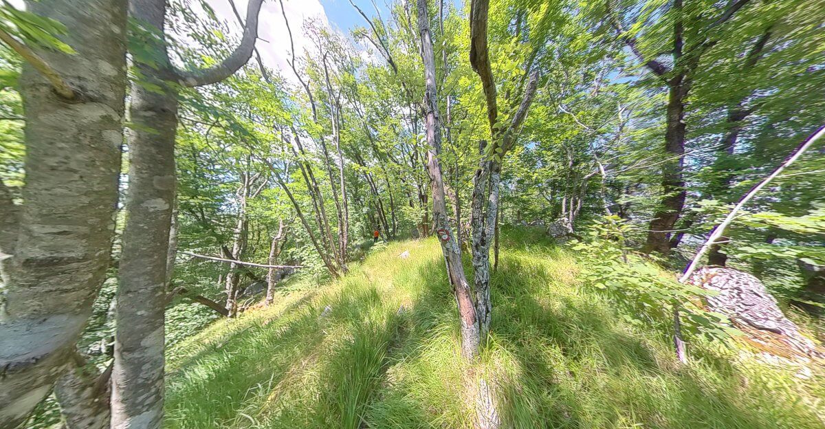
After around 700 m (10 minutes) you'll arrive at a junction where the OPO joins an overgrown logging track coming in from the north. Take the track to you left, following the trail westward, south westward, and the southward. The walking is very pleasant, the tree canopy opening up in places to allow rich green grass to cover the forest floor.

500 m (7 minutes), after leaving the previous junction, you arrive at another. Here the forest track is broader and appears more frequently driven. Take a left and follow the track around the corner to continue southwards, ignoring the track on your right 100m further along. Instead you’re looking for a path on your right het another 100m on. The route can be difficult to spot and the path appears to be a dead-end, but look carefully and you'll spot the familiar red and white way-markings leading off in a roughly southerly direction. There is a reason the route is difficult to see, in many placed there is not really a path at all.

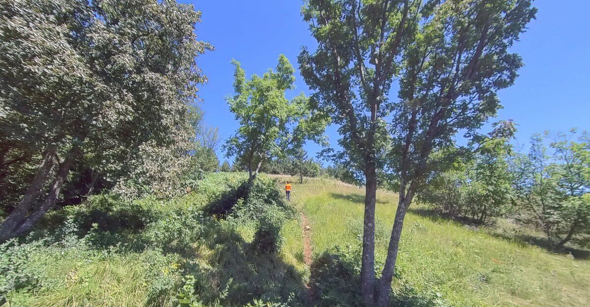
Grassy forest as the Opatijska planinarska obilaznica approachs Zvončev Vrh.
VR Logo Grassy forest as the Opatijska planinarska obilaznica approachs Zvončev Vrh.

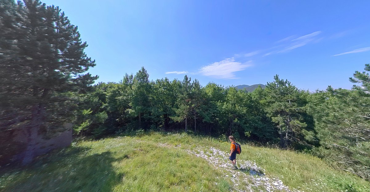
Steadily climbing, the route shortly turns westward, bends southwards again with the contours, before finding the ridge line and continues northwards and then north westward towards Zvončev Vrh. Whilst often tricky underfoot, and with route finding challenges, this is a pleasant section of the walk, not fully forest, not meadows, but a combination of the two. Zvončev Vrh (972 m) is reached around an hour from Majkovac.

KT 5 to KT 6 Summit of Budišinac (948 m)
Distance1.2 Km
Total Ascent35 m
Total Descent60 m

Depart Zvončev Vrh heading north westward and downhill to meet a signposted junction shortly before reaching the cleared strip of a buried gas pipeline. Turn sharply southwards along a broad shaded path to reach a junction of forest tracks about 12 minutes after leaving KT 5.

Remember this point, as you'll return to it later. There are no signposts, so seek out the fainter path that heads south south-eastwards uphill towards the summit of Budišinac reached in another 15 minutes over some tricky ground. Total time 25 to 30 minutes from Zvončev Vrh.

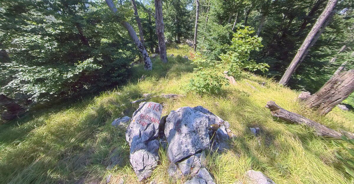
Opatijska planinarska obilaznica KT 6, the rocks on Budišinac's summit.
VR Logo KT 6, the rocks on Budišinac's summit

There is no few from Budišinac's summit, too many trees for that. The metal control stamp for the diary is found on one of a huddle of rocks.

KT 6 to KT 7 Lovačka kuća Brdo (825 m)
Distance1.4 Km
Total Ascent0 m
Total Descent110 m

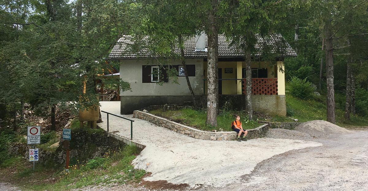
From Budišinac's summit, return to the previous junction and take the forest track southwards. From the junction it is 1 Km, 15 minutes easy downhill walking to the hunting lodge Brdo (Hill). KT 7 is 10 metres or so along the road that heads north from the private hunting lodge by a sign reading "Šumska cesta" on the retaining wall.

For those walkers splitting the OPO into multiple day excursions, a waymarked path leads from here down to Veprinac.

Opatijska planinarska obilaznica KT 7, Lovačka kuća Brdo.
VR Logo KT 7, Lovačka kuća Brdo

KT 7 to KT 8 Summit of Brložnik (1093 m)
Distance3.1 Km
Total Ascent260 m
Total Descent10 m

From Lovačka kuća Brdo follow the forestry track north westwards, crossing through a vast cleft in the trees where red and yellow poles mark a buried gas pipeline (900 m, 15 minutes), to reach a fork in the track a further 100 m (2 minutes) or so after. The track on the right is destined for Veliki Planik. Take the left track, roughly westward and gently uphill, for 700 m (22 minutes) to reach yet another junction where an older track is signposted Brložnik. Take this track to re-cross the buried pipeline and 200 m later, to pass under electricity transmission lines. It's now that the path grows thinner and more interesting. As the summit of Brložnik draws closer the Opatijska planinarska obilaznica becomes wilder, rockier, and in some places pathless. If you like me, this is what you've come for, a taste of wilderness and adventure. But if not, don't worry, keep an eye out for the red and white way markings and you'll be fine, reaching the summit in around an hour and twenty five minutes after leaving the hunting lodge. The log book stamp is on the base of a low concrete survey plinth. The best viewpoint is a little further on and a slight detour from the path.

The Opatijska planinarska obilaznica approaches the summit of KT 8 Brložnik.
VR Logo The Opatijska planinarska obilaznica approaches the summit of KT 8 Brložnik.

KT 8 to KT 9 Summit of Orlove Stijene (1072 m)
Distance0.9 Km
Total Ascent50 m
Total Descent75 m

It's a short distance from KT 8 at Brložnik to the OPO's next control point on Orlove Stijene Eagle Rock, less than a kilometre with only 50m or so of ascent, but it will likely take longer than the 15 to 20 minutes you might expect.

The descent from Brložnik is steep but clearly worn. A plastic coated cable provides assistance over the worst terrain, and where the route is less trodden, the red and white markings painted on trees and rocks will guide you.

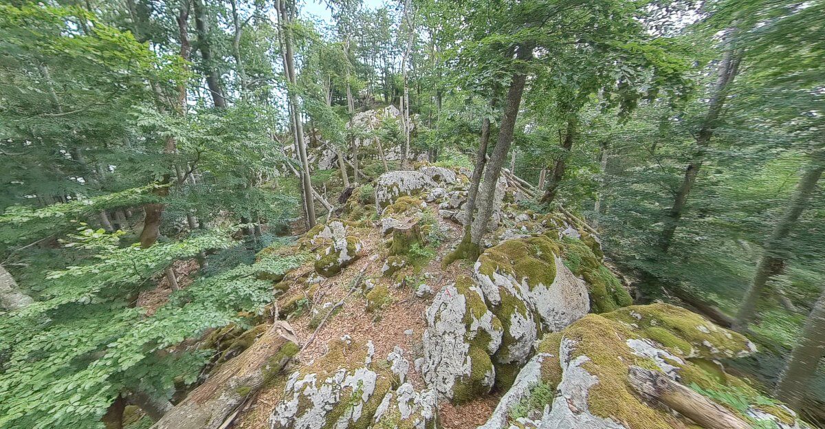
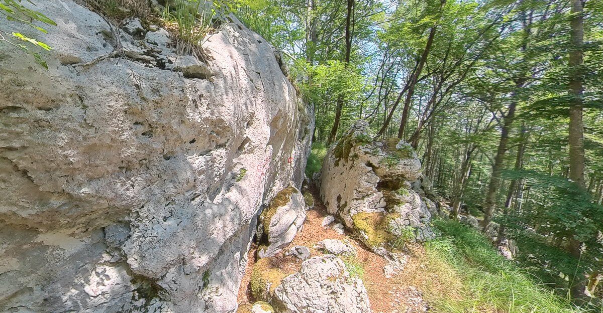
Now the OPO enters a labyrinth of typical Karst country named after Tihoraju Jelušiću, a mountaineer from Opatija who lived from 1909 to 1984. You may spy his name painted in red upon a rock face as you enter. Here crags and drops abound, and on approaching the col between Brložnik and Orlove Stijene, keep an eye out for the deep shaft that fissures the forest floor. Indeed, keep at least one eye on wherever you tread, it would be an easy thing to twist an ankle on this broken ground or slip on some moss covered rock in the wet.

The Opatijska planinarska obilaznica enters Tihoraju Jelušiću's Labrynith.
VR Logo The Opatijska planinarska obilaznica enters Tihoraju Jelušiću's Labrynith.

Beyond the labrynith is a pleasant forest for young beech. The trees trunks not so mighty, the canopy open enough to let the sun through and for grass to grow amongst the leaf litter on the woodland floor.

Control point 9 on Orlove Stijene is actually a short dog leg off the main Opatijska planinarska obilaznica path, so you'll reach a signposted junction first. Take the dog leg eastward for 100 m to reach forested summit where, 40 minutes after leaving Brložnik, the stamp can be found epoxied to a great boulder.

KT 9 to KT 10 Summit of Crkveni Vrh (1101 m)
Distance4.7 Km
Total Ascent185 m
Total Descent155 m

Return to the previous junction and take the path signposted Crkveni Vrh. The path remains charmingly narrow, twisting and turning for the first 800 m until a forestry track is reached. On the map it may appear that you'll need to go straight across this track, but it is more of left turn and then quick right. Or turn right and a quick left. Follow this track westward for around 400 m to where it broadens for turning or perhaps parking. Look for a waymarked path (once a track but now overgrown) heading north westward into the forest. After another 500m the track turns south west and then south when it joins a track coming in on your right. Continue southward over the buried gas pipeline to join a broader gravel track at a sharp bend, continue south. After around 4 Km, an hour and a quarter after leaving Orlove Stijene you'll need to take the dirt track on your left. The track is signposted Crkveni Vrh and doubles back on you as it climbs, passing after a few metres around the simple barrier. Continuing climbing as the dirt track turns south, wiggles, and finally reaches the antenna tower on the summit of Crkveni Vrh about an hour and a half from Orlove Stijene. Unfortunately there is little to no view from the top. The stamp can be found on the wall of the concrete shed passed before the final ascent.

View of Učka from the summit of Crkveni Vrh.
VR Logo View of Učka from the summit of Crkveni Vrh

KT 10 to KT 11 Planinarski dom Poklon (922 m)
Distance0.8 Km
Total Ascent0 m
Total Descent160 m

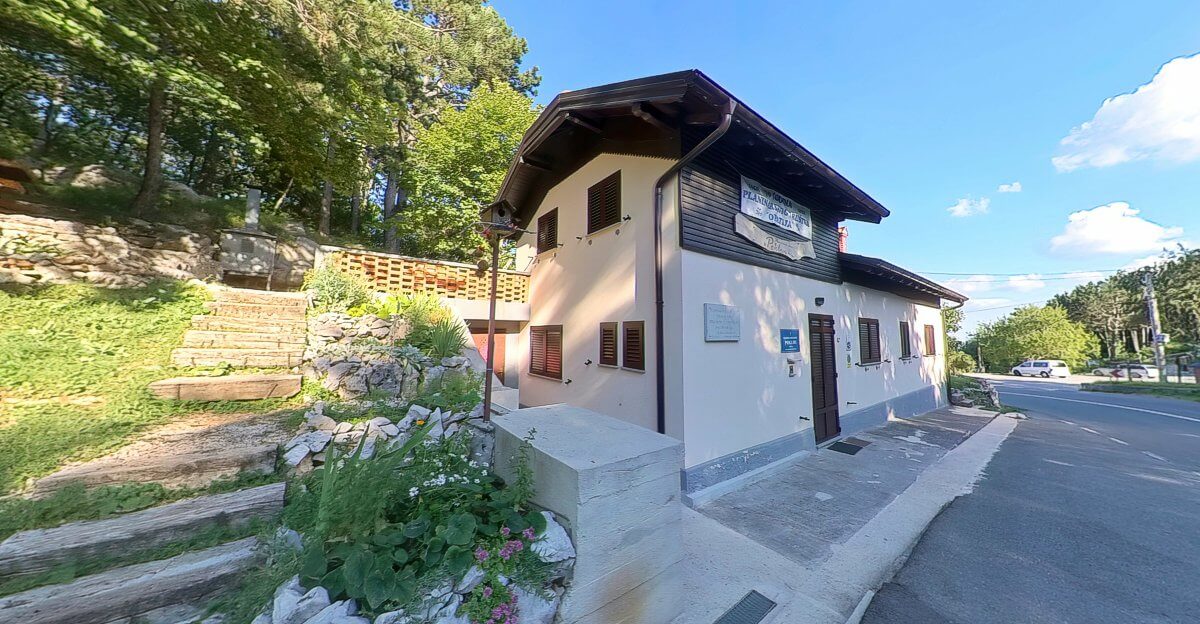
From Crkveni Vrh it a short 15 minute walk to Planinarski dom Poklon. The path leaves the dirt track up which you came just opposite the concrete shed, leading south then south west into the forest. Shortly that path, now heading south, joins a track. Where that track bends to the west, take the narrow path that continues southwards to emerge behind Planinarski dom Poklon. The stamp for KT 11 can be found on the outside wall of the mountain hut beneath the blue name plaque.

Planinarski dom Poklon.
VR Logo Planinarski dom Poklon.

KT 11 to KT 12 Summit of Vojak (1401 m)
Distance3.5 Km
Total Ascent440 m
Total Descent5 m

Cross the road in front of the mountain hut, passing through a strip of woodland in to and out of the carpark, taking a clear path uphill from a circle of wooden sculptures. The mature beech forest here is beautiful most of the year round, and offers pleasant and shady walking in the summer months. The trail zig-zags on the steeper sections, and cross the tarmac summit road three times before reaching the Topol spring on the right of the path after 1.6 Km, 275 m (~1 hour). 0.5 Km and 50 m of ascent later (~15 mins) some picnic benches and educational information boards are reached. Here a trail branches westward, ignore it, you'll be coming back this way. Another 0.7 Km, 70 m ascent (~21 minutes) and you'll reach that tarmac summit road for a fourth time.

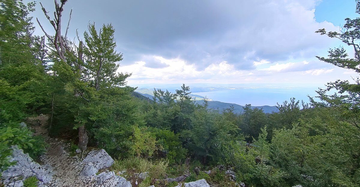
Turn right along the road. Where the road bends to the left, take note of the trail comes in from the right, this is the previously mentioned westerly trail and the route of your return. A second waymarked trail joins from the right a few moments later, take this (or follow the road). Towards the end of this short trail the trees become stunted and views over the bay open up. Whilst only a stone’s throw from the summit road, it has an air of somewhere more remote.

On the approach to Vojak's summit.
VR Logo On the approach to Vojak's summit.

The road is joined once more. Follow it up hill beneath the TV and surveillance antenna to a small car pack. Here gravel path leads the final 200 m along the summit ridge to the observation tower on Vojak's 1401 m summit.

KT 12 to KT 13 Slap Rečina (637 m)
Distance7.4 Km
Total Ascent35 m
Total Descent746 m

From the summit of Vojak, retrace your steps to where the alternative route of the OPO enters the forest at the bend in the road. Some pleasant views from the ridge can be found before the trail double backs on itself with a short detour to cave, before re-joining the ascent route at the interpretation boards. Continue the descent to Poklon.

At the carpark find the steps with the view, walking down to a forestry track signposted Dol and Opatija. Follow that trail for 0.8 Km (about 12 minutes) to where a carved wooden owl stands guard of a junction at which a signed path drops down to the left. Follow that path downhill for 0.7 Km to another junction. The track to the left (north eastward) is a shortcut to Ranch Bubač, but the OPO continues eastwards a little longer before turning north to the ranch.

Continue on the track past Ranch Bubač until reaching the bridge over the Banjina River. Don’t cross the bridge, but instead the take the path westward above the river’s southern bank. Follow this path until a junction is reached, 0.8 Km (12 minutes). Continuing along the path will take you to coastal towns of either Ičići or Opatija, so instead turn westward and still downhill along the path signposted Slap. 0.3 Km (4 minutes) later you reach the Banjina River at a low concrete dam. A 3 minute detour south westward along the path past a memorial plaque takes you to Slap Rečina and check point 13.

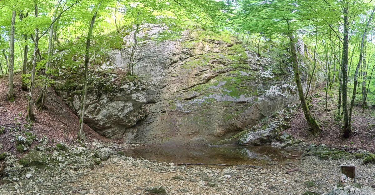
In the summer months, it’s likely that the river will be low and the waterfall dry. Whilst disappointing, the flip side is that this will make your onward easier as several river crossing are mandatory. The zig (stamp) for the control point 11 is on a rock indicated by red and white paint.

Slap Rečina.
VR Logo Slap Rečina, aka Slap Banjina.

KT 13 to KT 14 Summit of Pećnik (641 m)
Distance4.1 Km
Total Ascent140 m
Total Descent175 m

From Slap Rečina return along the same path to the low concrete dam then continue following the path on the Banjina’s right (south eastern) bank for a minute or two before reach an area where the river broadens beneath a water cut crag. Hopefully the water will be low enough to cross here without getting wet feet as you’ll see the path continue into the forest on the opposite river bank.

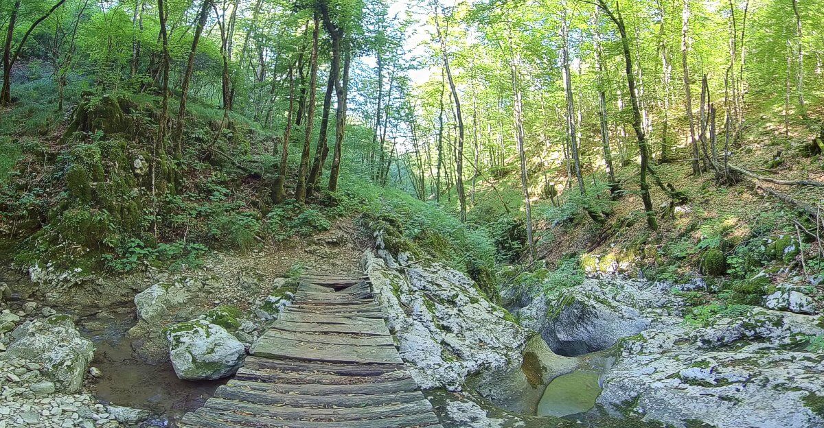
Having forded the Banjina, the path climbs steadily for five to six minutes before reaching a junction. Take the downhill path to head back to and ford the Banjina and return the right hand bank yet again. The OPO remains on this side of the river for a third of a kilometre before crossing again, this time at an aging wooden bridge, and you should ignore the uphill and signposted path on your right.

The Banjina River has sliced deep into the limestone rock here, and with the water flowing it can be quiet impressive. Continue along the path, now on the right hand side of the Banjina as the river falls away below you. 0.6 Km (9 minutes) after the wooden footbridge, the path will deposit you at the side of a forest track. Follow this track much in the same direction, i.e. north eastward through forest and clearing, passing a carved wooden bear. Shortly after the forest track loops to the left, descends, and loops back to the right so that it now heads eastwards with the A8 state road entering the Učka tunnel on your left.

Bridge over the Banjina river.
VR Logo Bridge over the Banjina river.

Since the time of writing, much work on a second tube for the tunnel has taken place, and any description written here may soon go out of date. However the aim is to leave the forest track for the service road that goes under the A8 / B8 state road. On passing under the A8 / B8, the service road turns to the left, at the bend, a track leads uphill on the right. Take this uphill track. It soon bends round to the north and passes, again at time of writing, a collection of shed like buildings. Continue pass these, and any beehives you might encounter, to a fork in the track, take the waymarked track to the right. It can get messy here, with new tracks being cleared, way marking destroyed, so be alert for a junction and signed path on you right for Pećnik, approximately 0.8 Km (12 minutes) after leaving the shed like buildings. You’ll be returning here, but for the moment take the 0.5 Km, 75 m climb to the 641m peak of Pećnik.

KT 14 to KT 15 Poljane, on the path to Opatija (189 m)
Distance3.8 Km
Total Ascent1 m
Total Descent440 m

Having rested weary legs on the throne like concrete and rock seat and enjoyed the views from Pećnik’s summit, the hiker must now descend back to the main track that skirts the hill. Continue on this trail eastward, taking the narrower waymarked path when the opportunity arises. Continue along this path and under the A8 / B8 state road through a convenient tunnel. With the completion of the second Učka tunnel tube, the B8 is due to be widened to a dual carriageway and become the A8 as it already is on the Istrian side of the tunnel. What arrangements for crossing here then, I do not know.

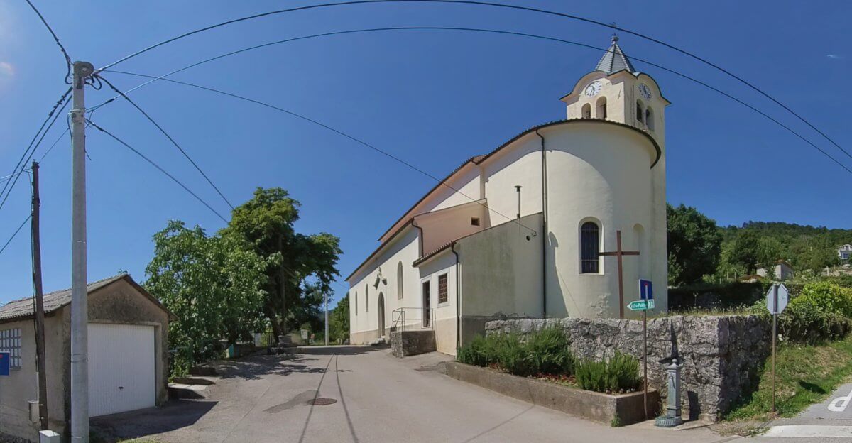
From the tunnel descend a grass and rocky path onto the upper streets of Poljane. Here follow the road north a 0.3 Km (4.5 minutes) before taking the stairs on the right hand side of the road to emerge behind Poljane’s cemetery. Head along the road once more and around the eastern side of St. Peter’s church to a cross roads. There is a public water tap here should you need to quench your first.

St. Peter’s church and water tap, Poljane.
VR Logo St. Peter’s church and water tap, Poljane.

At the cross roads turn right, following the foot path signs for Opatija downhill. The route is well signposted, even passing through a boat yard. Descend another staircase, and join a road heading south eastward downhill for another five to six minutes before reaching the top of yet more stairs. At the bottom of these stairs turn left onto a short road between houses and emerge at a sharp serpentine bend near a bus stop. Head downhill a short distance until another serpentine bend in the road is reached. Take the track signposted Opatija between the terraced gardens. Within a minute the track becomes a foot path and turns to the right, dropping down behind gardens.

The Opatijska planinarska obilaznica follows an older path now, gently dropping in altitude as it heads north eastward along the hillside. 0.9 Km (13.5 minutes) after leaving the road, a junction is reached with a path that climbs from Ičići and up towards Veprinac. This KT 15.

KT 15 to Opatija
Distance3 Km
Total Ascent5 m
Total Descent180 m

From KT 15 continue along the path as it gently descend north eastward until a road is reached above Opatija. Take the first road on your left, heading southwards, then at the next opportunity head northwards. Reach and cross Nova Cesta (New Road), turn left and then descend the stairs on your right. Turn left on reaching the road, walk a short distance then turn right again, descending all the time. Reach and cross Ulica Maršala Tita to the stair case signposted "Taxi-Boat". The stairs lead down the Lungomare (promenade by the sea) above Opatija's Marina. Follow the seafront promenade north east in front of the Admiral Hotel and on until you reach the start.