
ESC - Slovakia -
Gerlachovský Štít
, 2655m - Info | Trip ReportIntroduction :
Gerlachovský Štít (Gerlach Peak) is the highest peak of the High Tatra (Vysoké Tatry), a range of jagged granite mountains on the border of Slovakia and Poland, and are arguably the highlight of the much longer Carpathian mountain chain to which they belong.
The High Tatra stretch a mere 25 km east to west, and this somewhat accounts for the shear density of human traffic during the summer season. The Tatra National Park or TANAP, established in 1949, has imposed strict rules to protect the environment and the safety of those who use it; including access restrictions (see Routes& Paths), and a prohibition on wild camping.
A small fee is charged for entry to the National Park and fee collectors will be encountered on the paths as you enter the mountains. These contributions go towards the upkeep of the park; signs, path repairs, etc. Keep your ticket as you may be asked to see it latter.
Routes :
The translation of a few key works will help you understand both the map and route description:
chata - mountain hut / refuge, dolina - valley, dom - mountain hut / refuge, pleso - lake or tarn, štit - peak
All official paths are waymarked with three horizontal bands of colour, the upper and lower being white and the centre either red, green, blue or yellow to correspond to the colour used on the maps. Signposts at significant junctions give an indication of the walking times to major destinations. It is forbidden to walk off these trails without an official guide, and the high level routes in the National Park are only open between July 1st and October 30th.
On steep ground it is not uncommon to come across fixed chains for assistance. Elsewhere pegs and ladders enable ascent in territory that would otherwise be the realm of the climber.
Gerlachovský Štít lies off the waymarked network of paths and therefore an ascent requires the hire of a mountain guide. Despite the initial frustration this does has it's benefits. The reduced number of visitors means that the path is no motorway, the wildlife is more abundant, and you are less likely to get knocked on the head by dislodge rocks from above. More than likely you will only have to share the summit with your party, and this despite the lifting in 2004 of a restriction limiting the number of hikers to 30 per day.
The normal route chosen by the guides begins at Sliezsky Dom and follows the green trail along the eastern shore of Velické Pleso to the stream up above the small cliff at it's northern end. Here you leave the waymarked path, cross the stream, and begin hiking over rough ground in a generally westerly direction until the slope steepens and the animal trail like path delivers you to the foot of a gully. The route takes you across the gully to a set of fixed chains. Here one must be the most aware of loose rocks falling from above. You continue upwards to a narrow notch in Gerlachovský's South Eastern ridge. The ridge is too jagged and punctuated to be followed directly to the summit. Instead your guide will take you on an unseen path that meanders with the contours, over ribs, across snow (should you travel in early summer), scree and open rock to an area below the summit before ascending. The route is a labyrinth without walls, and you will be thankful for your guide's knowledge. Allow 3 to 4 hours depending of fitness and weather conditions.
Descent is made by travelling back down a short way into the glaciated basin, and then heading out over the South Western ridge. Again the path meanders, picking out the least exposed route. Even so, there is a section it cannot escape, and about a hundred metres of chain protected ladder rungs is encountered. There after there is more scrambling until the easier slopes of the Batizovska Dolina is reached. A rough path is then followed southwards to Batizovska Plesa where it joins with the Tatranská Maagistrála, the pathway marked red on the map. Allow 3 to 4 hours depending of fitness and weather conditions for the descent. It is then a fifty minute walk following the path back to Sliezsky Dom.
N.B. Members of the UIAA affiliated clubs have more freedom and are allowed to climb without a guide. I have not located a source describing climbing routes and grades.
Getting there and away :
The Slovakian High Tatra are extremely accessible.
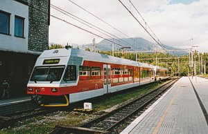 By Rail : The gateway to these mountains is the city of Poprad. The rail station here is also the southern terminus of a modern electric railway that serves the valleys beneath the mountains. The stations of the electric railway make wonderful jumping off points for many forays into the wilderness, and in addition provide a good link between villages and accommodation. The biggest resort is Stary Smokovec. Visit the website of the Slovakian railway to learn more.
Accommodation :
Camping : There is no camping permitted with in the National Park unless at an established campsite.
 Mountain Huts: There is an extensive network of mountain huts chata or dom open to all. They vary in size from the vast concrete hotels like Sliezsky Dom (right) to small isolated refugees. They will serve meals and provide reasonably priced accommodation.
Hotels & Hostels : Check out the tourist information at www.tatry.sk.
Visit www.tatry.sk for details of available accommodation in each category, plus much more.
Maps and Books :
| OpenStreetMaps shows the ascent routes. |
 German cartographers freytag & berndt produce an adequate 1:50,000 map of the High Tatra; "WKSK 1, Vysoké a Západné Tatry". The legend includes English, contours are at 20m intervals, and paths are colour coded to match the waymarkings on the ground.
 Cicerone Press publish "The High Tatras" by Colin Saunders & Renatá Nározná. This is an excellent guide to both the Slovak and Polish side of the mountains, the forth edition was published in March 2017.
ISBN 9781852848873.
Useful Links :
The website of the Slovakian Tourist Board.
You can read the latest UK government travel advise to Slovakia at https://www.gov.uk/foreign-travel-advice/slovakia.
For a weather forecast, check www.mountain-forecast.com.