ESC -
Serbia - Midžor
, 2169m - Info | VR TourIntroduction:
After the break up of the former Yugoslavia, there are three popular contenders for Serbia's highest peak, Djeravica (2656m), Pancicev Vrh on Kopaonik (2017m), and Midžor Миџор (2169 m).
Djeravica (2656m) lies in the once Autonomous Province of Kosovo which declared it's independence from Serbia in February 2008. Serbia may still claim this peak is the highest point in the entire Serbian Republic, and indeed in October 2008, the majority of the UN states backed a Serbian judicial initiative on Kosovo aimed at determining whether the secession was legal. As of February 2009, only 55 UN states (including 22 of the 27 EU countries) had recognised Kosovo's independence.
For many years Yugoslav children were educated to believe that Pancicev Vrh (2017m) on Kopaonik was the highest mountain in Serbia. Certainly the mountain used to be entirely within Serbia, however the southern half of the peak is now within Kosovo.
In more recent years there have been claims that Midžor (2169 m) is Serbia’s highest peek, and this is now generally accepted at the nations highest point. A 1:50,000 Serbian map shows the border with Bulgaria crosses through the summit.
Crowned by a short square pillar of stone and concrete, Midžor is located some 330 km from Belgrade, and 70 km from the city of Niš, in the the Stara Planina (meaning Old Mountains), a mountain range that forms a natural border between Serbia and Bulgaria. Above 1100 metres, Stara Planina is under snow for almost 5 months of the year, and thus is now being targeted for major ski development based around the nearby resort of Babin Zub.
Routes :
Distance :7 Km Height Climbed :610 m Duration :3 hrs 15 mins

|
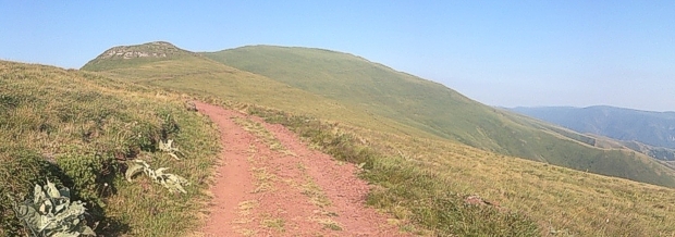
| Midžor viewed as on approach from Babin Zub. |
The shortest route to the summit of Midžor begins from the mountain hut at Babin Zub (1570m), and takes around 2hrs to 2hrs 30mins to the summit. Babin Zub is reached by a long rough road, continue along this track eastward and gain the ridge and ski slopes above. Here a distinct track, suitable for mountain bikes, leads around the north side of Žarkova čuka (1848m), continues in a NE direction, turning east beneath Prilepski vrh (1906m) and Tupanar (1955m) before turning SE beneath the main spine of the Midžor ridge. Around a kilometre later one arrives at a low ruin and turning circle. Whilst the track continues eastward along the ridge, take the sign posted path in a northerly direction before switching back eastwards to the triangulation pillar that marks the summit. This route is way marked, and hard to get lost on.
Distance :~10 Km Height Climbed :1440 m Duration :6 hrs

|
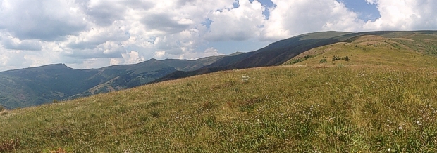
| Midžor viewed as on approach from Topli Do. |
Further routes, begins at the red roofed village of Topli Do. The first of these follows a track eastwards out of the town on the northern side of the river. Shortly it climbs up hill and turns northwards. Here the path is easy to lose, but keep to the crest of the ridge and it will soon be found again. The path heads for the knoll of Cićeina Čuka, put passes the unnecessary climb on the western side before climbing steeply up onto the Dugobilo spur. The spur is pathless, but keep to the crest and you will pick up an old trail running from east to west parallel to the main Midžor ridge. Here there are two options, the first is to climb steeply and directly upwards to a second wider track that follows the main ridge, and then follow this westward to the summit. Or, follow the first path westwards beneath the summit as it steadily climbs, and then, once west of the summit, climb up the grass covered slopes to the second wider track. Taking the latter option, follow the wide track eastward to its zenith and the site of a ruined building. Here a signed path heads northwards and then turns east to the triangulation pillar on the summit.
|
Please wait for Google Map to load here.
|
| GoogleMaps |
Distance :16.5 Km Height Climbed :1440 m Duration :7 hrs 45 mins

|
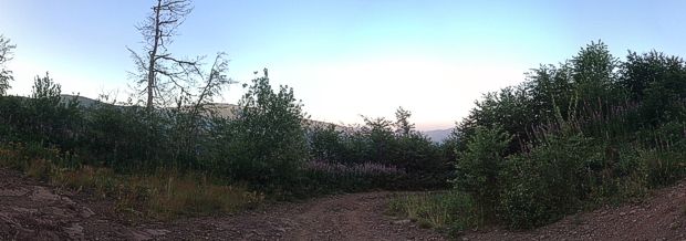
| Midžor seen through forest on approach to Babin Zub from Topli Do. |
Carl McKeating and Rachel Crolla in their book “European High Points” wrote that this was a route to be avoided and involved a long walk on forestry tracks. Carl and Rachel's route begins by following the road westward out of Topli Do on the northern side of the Rekitska river. It is not long before the track crosses the river, now to its western bank, and thereafter it's surface becomes a dirt and rock. Always heading in an approximately north western direction, the forest track crosses the Rekitska once again, and passes through meadows and forests in turn. There are occasional summer houses, roadside memorials, and log bridges, these becoming fewer and fewer until at length the track splits into two, one route heading eastward, the other westward. Take the westward track, and after many switch backs and the passing of a spring, you will arrive on the main ridge below the Babin Zub ski complex. The route as from Babin Zub is then followed. I took this route in August 2013 for my decent, much of it in darkness.
Getting there and away :
The nearest town in the region and gate way for those relying on public transport is Pirot.
-
By Air - The nearest internationl airport is at Niš (~1:50 by train to Pirot). However you will find more frequent and probably cheaper flights to Sofia International Airport in neighbouring Bulgaria (~2:30 by train to Pirot). After that you my wish to look for flights to Belgrade International Airport (6 to 7 hours by train to Pirot).
-
Bus and Coach- The main intercity bus operator in Serbia is Lasta. I have not been able to discover if they operate a service to this area from the capital.
- By Rail - The nearest stations to Midzor on the Serbian Railways network are in the towns of Bela Palanka, Crnilište, and Pirot.
Accommodation :
The hotel seeming to advertise itself the most, and should provide easy access to Midžor is the three star Hotel "Babin zub" built in 2000. (Babin Zub translates as Grandmother’s tooth.)
Hotel "Babin zub"
19300 Kalna-Knjazevac
Stara Planina
Serbia
Tel. + 381 (0)19 / 731 780
Maps and Books :
| OpenStreetMaps shows the ascent routes. |
 There was recently only one modern hiking map of the area, and this is Geokarta's 1:50,000 mountain tourist map of the Stara Planina. In the UK the map is available from Stanfords, but may be difficult to get hold off as was out of stock last I looked.
In Emergencies :
The following and appropriate telephone number should be used in case of emergencies;
Police: 92
Fire service: 93
Medical emergency: 94
The Gorska Sluzba Spasavanja ( GSS ) is the Serbian mountain rescue service. There website can be visited at www.gss.rs
Useful Links :
The Serbian Tourist Board Website has useful fact about travelling to Serbia.
Another usefull site is that of the Serbian Mountaineering Association https://pss.rs/en/.
Planinarsko društvo "Pobeda" is Serbian only website with a great collection of data on mountineering in Serbia and Montenegro, visit www.pdpobeda.rs.
You can read the latest UK government travel advise to Serbia at www.gov.uk/foreign-travel-advice/serbia.
For a weather forecast, check www.mountain-forecast.com.