ESC - Ireland -
Corrán Tuathail / Carrauntoohil
, 1039 - Info | Trip ReportCoomloughra Horseshoe :
On the afternoon of my father's sixtieth birthday, I had told him that we should spend more time together. Time that is, doing something more than bringing round his grandson, having tea and cakes, and watching television. Quality time, to use a phrase heard more often but little realised. We had not spent a day together, going somewhere, having fun, since I had sought my independence as a teenager, so I asked him to join me on one of my mountain trips. Carrauntoohil in Ireland, I suggested, would be an excellent choice. He was not sure, could he at this age stand up to such a physical challenge?
It was not until over a year later that the vision of father and son striding out into the wilderness became a reality. Of course I use the word wilderness lightly, since there is so little true wilderness left in the British Isles. Our pre-expedition trip was a day's mad dash to Snowdonia at the end of May. We left early in the morning encouraged by an excellent weather forecast, and drove four hours to North Wales. At a steady pace in weather that never quite matched expectations, we ascended the 905 m peak of Aran Fawddwy and returned to the valley in approximately six hours. My father was feeling fine and pushed me on the Irish question. When were we going?
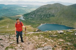
 Ascent of Caher
with Lough Coomloughra below.
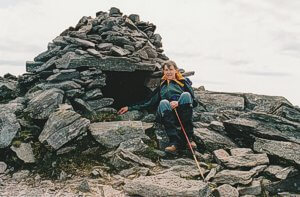
 Stone shelter on the first
summit of Caher.
"I hope you don't expect me to climb that!" My father exclaimed. And indeed from where we stood there was no discernable route up the steep pyramid like summit.
"Let's not think to much about that. Let's just think of this hill in front of us. We have all day." I replied, the latter sentence had become a mantra to be repeated whenever time passed without distance.
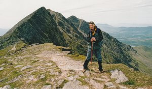
 From Caher we descended a
narrow ridge to below
the slopes of Carrauntoohil
But from there on it all seemed easier. The couple whom we watched clamber up Caher behind us overtook and turned out to be two athletic women just a little younger than my father's age. Perhaps it was this that triggered his determination thereafter.
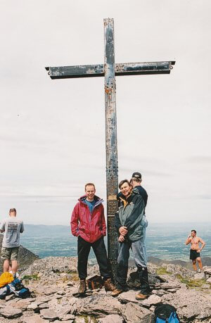
From Caher we descended a narrow ridge to below the slopes of Carrauntoohil and walked steadily up to Ireland's highest point along a broad path. We were joined by a group of twenty or so oddball walkers who had traversed the Beenkeragh ridge. They were a friendly, cheerful lot of mixed ability on a management training course led by "the first Irishman to have climbed Everest", or so we were told and had no reason to doubt. My father had his photo taken with him beneath Carrauntoohil's large iron cross. We had made it and we were justifiably proud.
 Standing beneath the cross on the
summit of Carrauntoohil,
highest mountain in Ireland.
It was around four in the afternoon by the time we picked a path up Beenkeragh's boulder strewn summit. The weather remained favourable, accommodating us with time for a short rest, the opportunity to take more photos, and admire the ground we had covered that day. Then, once again it was time to push on. From the top of the mountain, we had spied a probable path that ran diagonally up from the western end of Lough Coomloughra to an undetermined place on Skregmore's southern flank. Skregmore is the last mountain in the Coomloughra Horseshoe. It has three rounded summits, all below the magical 3000 ft line, and thus cruelly excluded from the Munro bagger's hit list. But it was satisfaction with the walk already behind us rather than any classification that caused us to cut short the official circuit and head down to the above mentioned path. The thought of a curry and pint waiting for us in Killarney may also paid a small in the decision.

|
| Ireland's highest mountain, Carrauntoohill, and Caher from Beenkeragh, Coomloughra Horseshoe. |
From the saddle between Beenkeragh and Skregmore's first hillock, we crossed grassy slopes and boulder fields before reaching the questionable path. A little further and now running parallel to the stream that feeds Lough Eighter, it's status was confirmed. Though we had only dropped half the height we had gained during the day, we felt that we were down. Now on easier ground, our pace quickened, the kilometre to the dam at the tiny lough's northern end was brisk.
There was now a choice, either scale the fence and cut across questionable ground to the shores of Lough Acoose and our car, or take the rocky track, at ninety degrees to our destination, down to the road. The latter was definitely longer, but the ease of walking along a clear track outweighed anything heathery moorland could offer this late in the day. I believe our choice was a good one, we reached the tarmac quickly enough and a hitched lift soon saw us back with our car.
