ESC - England -
Scafell Pike
, 978m - Info | VR TourIntroduction :
Situated in the Lake District National Park, Cumbria, Scafell Pike is the highest mountain in England. The mountain has been owned by the National Trust since 1920 when it was donated to them by Lord Leconfield, and thus garentee freedom of access.
Routes :
There are many walking routes to the summit of Scafell Pike. These are best grouped together by their starting points. Those looking for more advanced scrambling or climbing routes should seek specialist guides books.
From Wasdale
The Lingmell Gill Path or Brown Tongue Route
(4 Km / 2.5 miles, height gain 910m, Starting at NY181076 )
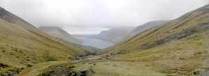 The Lingmell Gill path offers the shortest route to the summit of Scafell Pike, though should be thought no less strenuous for this fact. The path starts at the National Trust Campsite, Wasdale Head, following the course of Lingmell Gill, crossing it three times; the first on a wide bridge suitable for cars, the next time by a footbridge, and the final time at a ford. Having crossed the ford, the path ascends moraine of Brown Tongue to Hollow Stones, before climbing steeply up to the pass of Mickledore where one turns north east past a stretcher box to the summit cairn. On a clear day there are good views of "The Screes" dropping down into the deep Wast Water.
The Corridor Route
(6 Km / 3.75 miles, height gain 910m, starting at NY181076 )
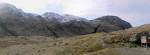 This route starts at Wasdale Head and passes through Burnthwaite Farm following an old pony trail up to the pass of Sty Head and home of a second emergency stretcher box. (This point can also be reach from Seathwaite at the head of Borrowdale, or via a traverse of Kirk Fell and Great Gable.) From the busy hub of paths at the stretcher box, walk east a short distance, dropping down a little to the right to pick up the "Corridor Route" path that traverse the north western slopes of Great End and the Scafell Pike ridge, cutting across various gullies as it climbs steadily towards Lingmell. It it possible here to continue the traverse toward Hollow Stones, Brown Tongue, and descend via Lingmell Gill. Instead, look out for the path that climbs to the col between Broad Crag and Scafell Pike. This path is clear on the ground, but is not in the same place as the public footpath marked in red on the O/S 1:50,000 maps, and in green on the O/S 1:25,000, but by the smaller black dashed line close the stream that also follows the fold of the col. Having reached the col, follow the narrow ridge south westward to the summit.
From Borrowdale
Grains Gill and Esk Hause
(6.4 Km / 4 miles, height gain 890m, Starting at NY235121)
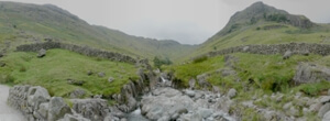 The route starts at Seathwaite where there is adequate parking along side the road. Walk south through the farm yard and follow the bridle track alongside the River Derwent signposted Esk Hause and Sty Head. A little after a kilometre the River Derwent splits into its two tributaries; Styhead Gill and Grains Gill. Stuck on the eastern bank, the bridleway follows Grains Gill the short distance to Stockley Bridge. Once across the picturesque bridge and beneath Seathwaite Fell, the bridleway seeks out Styhead Gill and once above Taylorgill Force Falls, hugs its bank up to Styhead Tarn and Sty Head from where the Corridor Route can be followed to the summit (or used as a return route). However, by following the footpath from Stockley Bridge alongside Grains Gill one eventually ascends to a path that traverses beneath the hulk of Great End (910m). At this junction, head south-eastwards to the pass of Esk Hause. From here, head westward to Calf Cove and climb to the col between Great End (now to the north) and Ill Crag (to the south). Traverse Ill Crag and Broad Crag, being careful not to mislay the path in cloudy weather, before descending into another col before the final ascent up Scafell Pike’s northeast ridge.
Getting there and away :
The Lake District National Park provide this information about public transport in the region.
Accommodation :
Camping - There are campsites National Trust run campsites in Wasdale and Langdale, and a miriad of independents all over the Lake District.
Youth Hostels - Check out the YHA website for further information.
Hotels and Rooms in Private Houses - These are plentiful. Visit www.visitcumbria.com for further information.
Maps and Books :
| OpenStreetMaps shows the ascent routes. |
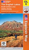
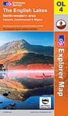
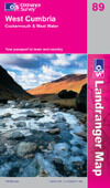 Ordnance Survey produce both a 1:50,000 Landranger and a 1:25,000 Explorer OL map of the region:
The 1:50,000 is sheet 89 "West Cumbria, Cockermouth & Wast Water"
The 1:25,000 is sheet OL6 "The English Lakes: SW area, Coniston, Ulverston & Barrow-in-Furness" covers Scafell Pike and approaches from the south. Sheet OL4 "The English Lakes: NW area, Keswick, Cockermouth & Wigton" is also required for those routes approaching from the north.
The 1:25,000 Explorer maps are prefered as they show additional detail such a fence and wall lines which make it much easier to route find.
Useful Links :
The Wasdale Web Information & Inspiration for the Wasdale valley and surrounding area of the English Lake District. Includes links for accomodation, webcams, guides, etc.
www.visitlakedistrict.com The official website of Cumbria Tourism.
The Lake District National Park Authority The Lake District National Park is the largest in England, covering fells, lakes, villages, towns and beaches. We look after this unique area, encouraging people to enjoy and understand its beauty and helping those who live and work here.
For a weather forecast, check www.mountain-forecast.com.