
ESC -
Belgium - Signal de Botrange
, 694m - InfoIntroduction :
Botrange lies in the Haute Fagnes, it's location marked by a 20th century Telecoms Tower, and an older artificial, earthen mound with stone steps made to raise a small part of the broad plateau from 694m to a magical 700m.
Haute-Fagnes, meaning "high fens", is one of the coldest, wettest places in Belgium. In winter it becomes the country's premier cross-country ski resort. The region's unique natural habitat was recognised and protected by the creation of the Haute Fagnes-Eifel National Park in 1957, and there is a visitors centre close to the tower. The centre houses an information office and museum. They also arrange guided walks and sell 1:25,000 walking maps of the Haute Fagnes. Much of the National Park is open to visitors, but certain areas of the nature reserve are only accessible with a guide from the visitor centre.

|
| Earthern mound and telecomuniaction tower on the Signal de Botrange © D. Stillingfleet |
Routes :
Whilst the summit of Botrange can be reached by the N676, a more rewarding traverse can be made by taking the GR 56 / GR573 trail from Eupen. The trail hugs the Hill River, then takes forestry tracks and woodland paths through the forest until a fording of the river over to the western bank. Here the path crosses the marshy meadows of Grand Bongard and Petit Bongard. Keep an eye our for the red and white way markings. Infrequent sections of boardwalk confirm that this really is the trail, and when at last the boardwalk becomes more continuous you will be delighted that the bog trotting is over. Shortly after there is a bridge over the Hill River, with a picnic table on the opposite bank. Here the signs are somewhat confusing. The GR trails cross the river and continue south and then west round the open fen land. A more suitable route is provided by the boardwalk that traces the northern bank of the now narrow river, sign-posted Baraque Michel. Continue for a little over a kilometre and then cross over the stream on the boardwalk sign-posted for Botrange. This path crosses Fagne Wallonne before hitting the woodland corridor that boarders the N676 road. Follow the track along the forest edge until an opening leads out onto the Signal.
Total Distance 22Km, gaining approximately 430m in height.
|
Please wait for Google Map to load here.
|
| GoogleMaps |
There are many routes descending from Botrange to Malmedy and environs, each way-marked by coloured symbol. I took the trail marked with a blue band from behind the tower, south-east to the Nature Centre, and from there the blue stripe until a stream is met. A series of differently marked paths follow the course of the stream, which in turn takes on new names as tributary junctions are met. In places the path is narrow and fords the infant river many times, the swift progress possible on the forest trails exchanged for something a little closer to exploration. The forest trails terminate at a quarry just east of Bevercé, and though the river continues on through Malmedy, one has to walk along the roads.
Those ascending by this route from Camping du Moulin will cover 12Km and face a modest height gain of around 340m.

|
| Boardwalk on the Haute-Fagnes © D. Stillingfleet |
Getting there and away :
The Signal Tower is a few metres to the west of the N675 road north of the Malmedy and south of Eupen. Eupen is served by rail, check out the NMBS/SNCB website www.b-rail.be for timetables. There is no longer a rail service to Malmedy..
Accommodation :
Hotels - Visit the Belgium Tourist Office website at www.visitbelgium.com for hotel accommodation. Or use one of the many on-line hotel booking services.
Hostels - Visit the Belgium Youth Hostel Association website at www.laj.be to book a bed at their hostel in Malmedy.
Camping - There are two campsites in Eupen. Those who like music gigs should try Hertogenwald, Oestrasse 78, B-4700 Eupen. Tel.+32 (0)87 743 222. Email [email protected].
Alternatively try Wesertal Campsite, Rue de L'Invasion 68, B-4837 Baelen-membach. Tel. +32 (0)87 301 736. Email [email protected].
On the southern flank of the Haute Fagnes, just outside Malmédy there is Camping du Moulin, Route de la vallee 36, B-4960 Bevercé, Malmédy. Tel. +32 (0)80 799 020. Email [email protected].
Maps and Books :
| OpenStreetMaps, used as the source for many smart phone apps covers the area well. |
 The Institue Geographique National produce good 1:25,000 maps. Paths are better marks than on the 1:50,000 maps below, and include the colour codes symbols used to waymark the paths on the ground. An out of aligned brown contour overlay on my copy led to some confusion (how can this river run uphill?).
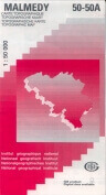 The Institue Geographique National also produce good 1:50,000 maps. Malmedy 50-50A covers the southern area of the Haute Fagnes-Eifel National Park including Botrange. Eupen 35-43 covers the north area including perhaps a more interesting if circuitous route to Botrange from Eupen via the Die Hill river.
Useful Links :
The Haute Fagnes-Eifel National Park can provide guided tours, for further information and photo gallery visit www.ful.ac.be/hotes/cnatbotrange/uk/welcome.htm.
For a weather forecast, check www.mountain-forecast.com.

|
| Haute-Fagnes meadow © D. Stillingfleet |