ESC -
Andorra - Coma Pedrosa
, 2942m - Info | VR TourRoutes :
Most routes to the roof of Andorra start just above the resort of Arinsal (situated at 1475m). The most popular route is the first outlined below, and includes 1470m of ascent over non technical terrain.

|
| Ascending Pic de Coma Pedrosa (right), with Estany Negre below and Pic de Sanfonts and Agulla de Baiau (centre) |
Option 1: Via Collet de Coma Pedrosa and Estany Negre
Distance: 7.3km
Ascent: 1470m
Leave the resort of Arinsal by following the main road up hill and north westward. Shortly after passing the Hotel Patagonia on your left hand side (you could park a car here), you will pass through a tunnel. The road continues on, but to the right there is a road that service some apartment blocks. Take this road, it is signposted to Coma Pedrosa, and soon becomes a dirt track that climbs and swings north westward. Follow the track as it ascends steadily along the valley side. Crossing over a cattle grid, the track swings sharply to the right. There are information boards here, and a signpost. The track leads up to Pla de l' Estany and Forcats i Estanys de Montmantell. You don't want to go this way. Instead, take the small path straight forwards. This path leads through meadow and forest, bridging two streams running down off the mountain, before climbing steeply to Collet de Coma Pedrosa. The pass is marked by a Natural Park information board, and there is a path here that leads off to the left up to the Refugi de Coma Pedrosa. Food, drink and accommodation are available here.
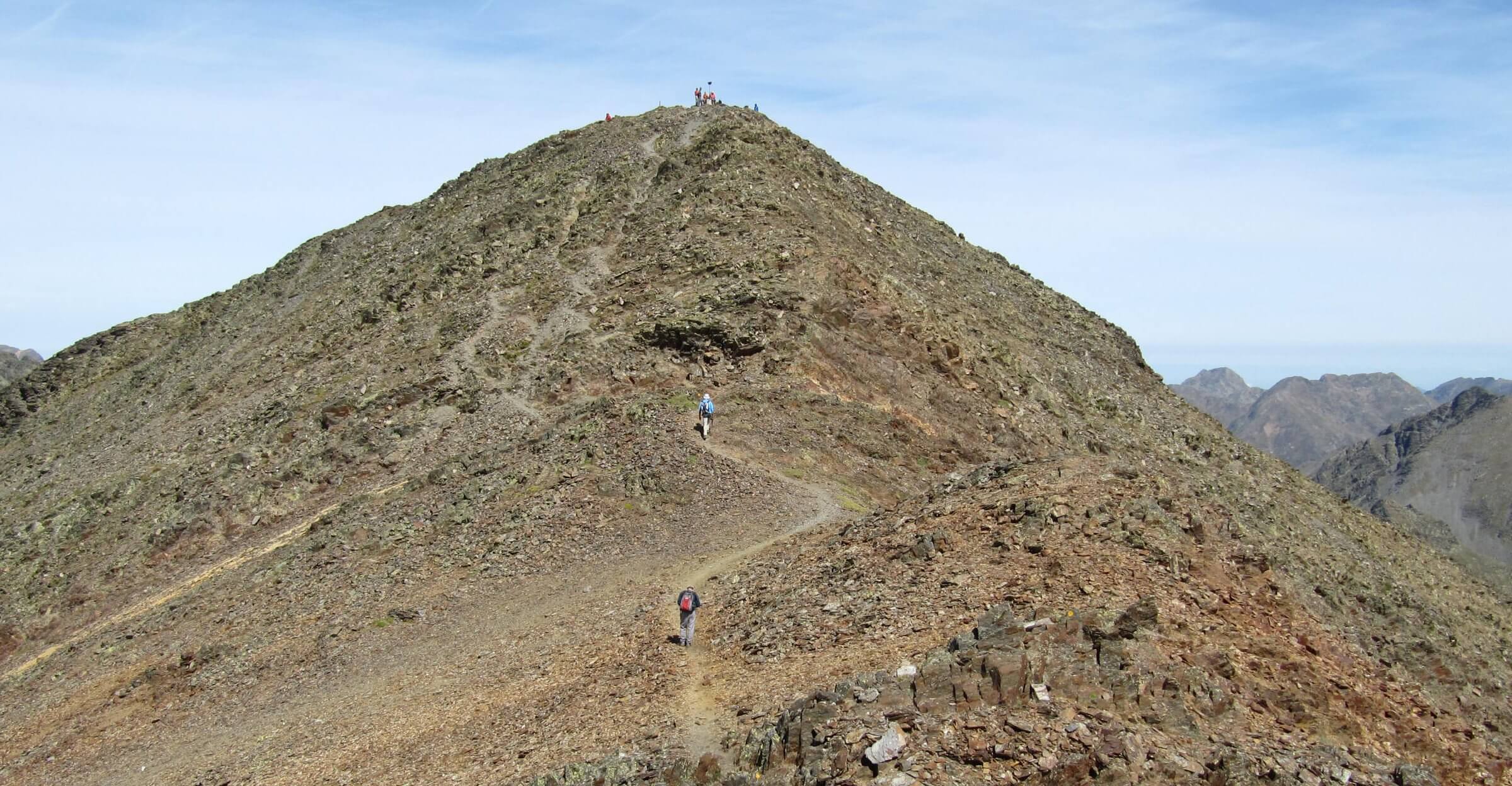
From the Collet de Coma Pedrosa, continue westward, at first dropping down to the valley floor, then rising again to reach the amphitheatre of Les Canyorques. Here the path turns and zig-zags in a north eastward direction to the first of two lakes, the Basses de l'Estany Negre. Continue on by and look out for the fallen signpost marking the division of the path. The GR11 will continue in the fold of the valley past the lake Estany Negre and into Spain. A second path climbs the scree slope to the right and climbs up onto Coma Pedrosa’s south ridge. This is the better way to go. Once the ridge is gained, follow it northwards to the summit and enjoy the views.
You can follow this route in a virtual reality tour, Click here.
| Option 1: Via Collet de Coma Pedrosa and Estany Negre |
Option 2: Via Refugi del Pla de l'Estany
Distance: 6.4km
Ascent: 1425m
Not shown on map above because waymarking of exact route is unclear. This is NOT a good route by which to ascend, the terrain is tricky and route finding difficult above the Refugi del Pla de l'Estany. We used this as a descent route.
As above, follow the GR11 trail along the track above Arinsal. At the cattle grid junction, follow the track as it turns steeply right. There is another zig-zag, and a drinking fountain. Continue following the track, leaving it on a narrow path for the deserted at Borda de la Coruvilla. Rejoin the track here and follow towards the Refugi del Pla de l’Estany, this hut is not manned. Somewhere between Borda de la Coruvilla and the Refugi, there is a path that climbs the steep slope up to Collada del Forat dels Malhiverns. We did not see this path on the descent and forged our own way down the steep slope visable from the Refugi.
Above the grass, shrub, and rock strewn slope, little stone piles, cairns, mark a route over the rocks, scree , and later an ankle breaking boulder field. Eventually, after one final scree slope you will reach the Collada del Forat dels Malhiverns, a pass between Pic de Baiau (to the north) and Pic de Coma Pedrosa (to the south). At the pass, follow the faint path northwards up to the summit of Coma Pedrosa.
Option 3: Via Pic de Sanfonts and Agulla de Baiau
Distance: 10.4 km
Ascent: 1815 m
Not shown on map above. This is a more adventurous ascent with some exposed scrambling and not shown in entirety on the Editorial Alpina map. We spoke to a group of lads on the summit who told us they had come this way.
Follow route one to the Collet de Coma Pedrosa, and then climb to the Refugi de Coma Pedrosa. From the refuge follow the path past the lake Estany de les Truites, and above the lake Pla de la Bassa de les Granotes and up to the pass of Portella de Sanfons. At the pass, follow the ridge northwards along the border with Spain to the Pic de Sanfonts. According to the Editorial Alpina map, the path ends here. Continue along the ridge to the Agulla de Baiau, no marked path, but from the summit of Coma Pedrosa, this ridge looks broad and unchallenging. The Editorial Alpina map, shows a path from the Agulla de Baiau to the pass of Portella de Baiau and the Pic de Baiau. From either the pass or Pic de Baiau, descend the ridge and continue up the faint paths to the summit of Coma Pedrosa.
Getting there and away :
The nearest town to Coma Pedrosa is Arinsal. An ascent can be made directly from here.
By Plane: There are no airports in Andorra. Fly to Barcelona, Spain, or Perpignan in Southern France and travel by rental car or bus.
By Train: There are no rail service to Andorra.
By Road: Regular bus services operate from Barcelona city and Barcelona Airport to the Andorran Capital. Visit Andorran Tourist Board Website and search for bus times under the communications menu, or visit The NovATel website, who will drop you off to Arinsal.
Accommodation :
A wide range of accommodation is available.
Hotels: My friends and I stayed at the three star Hotel Montané in early September. It was great value, and friendly. Check out the tourist office web links below for other hotels.
Hostels: Check out the tourist office web links below for further information.
Mountain Huts: The Refugi de Coma Pedrosa, located at 2260m, offers hot food and somewhere to rest on the ascent. The Refugi has a guardian, is open June to late September, and sleeps 72 people in dormatories. Tel +376 32 79 55 (June to October).
Camping: There is a campsite in Xixerella a few kilometres down the valley from Arinsal. Check out xixerellapark.com for location and rate. They also have 60, two bedroom, wooden chalets available to rent that will sleep 4 to 6 people.
Maps and Books :
| Please Wait for Open Street Map to load. |
| OpenStreetMaps shows the ascent routes. |
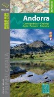
 Editorial Alpina produce a 1:40,000 walker's map of Andorra with contours at 20m intervals. Earlier editions of the map had shading which adds depth to the relief, but no indication of features such as scree slopes, rock outcrops or even cliffs. The 2016 / 2017 may be different. Footpaths are marked, as are the locations of mountain huts, peaks and some spot heights. The legend is in Catalan, Spanish and French, but most symbols are familiar and easy to understand. The thin guide book that accompanies the map appears to be either in Spanish or Catalan.
Useful Links :
Both the government of Andorra's official Tourist Office Website, and www.andorra.com (an unofficial tourist website) have useful fact about travelling to Andorra and to accommodation in the principality.
The Pal Anrinsal Website has great local information, hotels, resturants, etc, and include an interactive panoramic style map.
You can read the latest UK government travel advise to Andorra at www.gov.uk/foreign-travel-advice/andorra.
For a weather forecast, check www.mountain-forecast.com.