Those attempting the CMD Arête start at the North Face car park near Torlundy, pass through the forest above the golf course to gain the banks of the Allt a' Mhuilinn. There is a good path along the banks of the river all the way to the CIC hut which lies within the encircling cliffs of Ben Nevis, and steep slopes of the CMD Arête, and Càrn Mòr Dearg. Before entering the valley however, those on the ascent need look out for a path on their right that will lead them to Càrn Mòr Dearg. It is not an obvious path at this point, and many people, including myself, gain the Munro of Càrn Mòr Dearg (1220m) only after climbing the steeper slopes further up the valley. The fun begins from the summit of Càrn Mòr Dearg. Ahead the ridge narrows as it heads first southwards then south east. At points one might call the ridge knife edge, in other places, it is a jumble of rock blocks that one must haul oneself up and over. Eventually one arrives on the south east slopes of Ben Nevis, the ascent of which is rocky and or snowy (depending on the time of year) and is safely made following the line of posts.
The photos used in this tour were taken during the Easter break of April 2014. To the pleasure of all on the Scottish mountains, this was a weekend of brilliant sunshine and bright blue skies. On route from the North Face car park, I walked for a while with a family along the banks of the Allt a' Mhuilinn. The mother, father, daughter, and son were headed to the CIC hut. We parted when I peeled off to the left and climbed towards the first of Càrn Mòr Dearg subsidary peaks, Carn Beag Dearg.

|
|
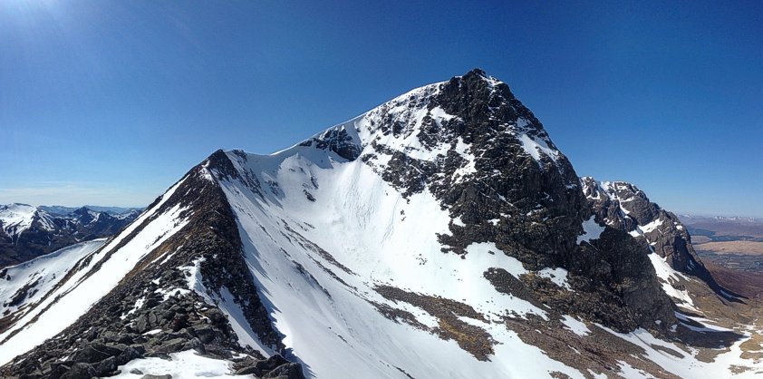
Ben Nevis from the Càrn Mòr Dearg Arête
|
Each panoramic photo takes around 3 to 5 minutes to make, so on the summit of Càrn Mòr Dearg's second subsidiary summit Carn Dearg Meadhonach (1179m), I was over taken by a walker from Ireland. I walked with Brendan for the remainder of the day. With ice axes in hand, we crossed a snow covered CMD Arête then climbed to the snow buried summit plateau of Ben Nevis itself. Despite the snow, the sun had drawn walkers up the Mountain Path in their hundreds. We all stopped to take the obligatory photos; standing next to the triangulation pillar, or the emergency shelter. Only a foot or so of the pillar stood above the snow, on a wet summer's day one would have first climbed a cairn. So on this day, the snow must have been a couple of meters deep (see photos below).
Brendan and I followed the Mountain Path and the crowds down as far as Lochan Meall an t-Suidhe, then peeled off to the right, and right again at the next junction, onto a less than even path under Ben Nevis' north face to the CIC hut. After a short break in the cold shadows, we crossed the Allt a' Mhuilinn over a snow bridge and headed back down stream.
The following day I headed up from the youth hostel to complete the section of the Mountain Path that linked up to where Brendan and I had peeled off to the CIC hut.


