ESC - Poland -
Rysy
, 2499m - Info | Trip ReportIntroduction :
Rysy (Linx or Scar/gashes) lies in the High Tatra, a range of jagged granite mountains on the border of Poland and Slovakia, in fact this peak is shared by both countries.
The High Tatra stretch a mere 25 km east to west, and this somewhat accounts for the shear density of human traffic during the summer season. The Tatrzanski Park Narodowy or TPN, established in 1954, has imposed strict rules to protect the environment and the safety of those who use it. Walking off the trails is forbidden.
A small fee is charged for entry to the National Park and fee collectors will be encountered on the paths as you enter the mountains. These contributions go towards the upkeep of the park; signs, path repairs, etc. Keep your ticket as you may be asked to see it latter.
Routes :
There are two paths to the summit of Rysy; one from the Polish side and one from the Slovak side. Since both countries joined the European Union in May 2004, it is now possible to ascend from one side and descend the other, and this is undoubtedly best done travelling north to south, i.e. from Poland into Slovakia.
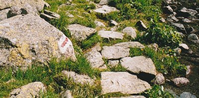
The route starts at the refuge Schronisko przy Morskim Oku at the northen end of tarn Morskim Oku (1406m). A trail, waymarked with white and red parallel stripes, hugs the water's eastern shore before climbing a stairway to a second tarn, Czarny Staw pod Rysami (1,580m). The path fords a shallow river linking the two tarns and again hugs the eastern shoreline. So far, the walk has been pretty easy going, but the way on is more strenuous and climbs steeply, often meandering for the best line to the summit. Waymarking makes route finding easy in clear weather, and fixed chains have been installed on exposed ground, in reality these are probably not needed. Snow fields may have to be crossed late into the summer, a path will have been trodden and no special equipment is needed.

Waymarking on the red routes.
The descent begins over broken rock, and the trail is again waymarked with white and red paint. Within half an hour or so, the refuge Chata pod Rysmi (2250m) is reached. From here the path continues past the Zable Pleso (Frog lakes), and descends via a series of zigzags into the sub-alpine zone typified by dwarf pine. Shortly after the path bridges a stream and then joins the blue trail which should be followed south into forest towards the refuge at Popradské pleso. Here the a red trail, a section of the Tatranská magistrála, can be followed southwards to Strbske Pleso (1350m) on the Tatra Electric Railway (see Slovakian section for getting there and away). Expect to take 3½ to 4 hours for the entire descent and allow additional time to relax and drink at the mountain refuges.
N.B. High level routes in the National Park are only open between July 1st and October 30th.
Getting there and away :
Whilst the refuge at Schronisko przy Morskim Oku is the most practical starting point for the ascent of Rysy, vehicular access to both the hut and lake is strictly controlled. Private cars must be parked near the valley floor at a place called Palenice Bialczanska, entrance to the National Park. This is a distance of 9km and would add about 2 hours if walked. But there is an alternative to trudging along the asphalt road. Horse drawn carts provide a regular passenger service, stopping a kilometre shy of the lake.
The nearest town and main access point on the Polish side of the High Tatra is Zakopane. The nearest airport is at Krakow, and the two towns are linked by both rail and bus services. Warsaw is likewise connected.
From Zakopane there is a bus service to and from Palenice Bialczanska.
Alternatively, if entering from Slovakia, a bus can be taken from Stary Smokovec and it's neighbouring villages to Lys� Polana close to the boarder. Here one can walk through the customs post and either hitch a lift or walk the kilometre to the National Park entrance.
Accommodation :
Hotels: Zakopane offers a variety of accommodation including hotels. Check out www.staypoland.com to search for a hotel.
Mountain Huts: A network of well maintained huts are operated in the High Tatra. The refuge Schronisko przy Morskim Oku on Rysy's northern slopes is highly popular. On the Slovakian side, Chata pod Rysmi offers limited beds.
Camping: Camping is prohibited within the National Park except at official campsites. There are however two campsites at the southern end of Zakopane.
Maps and Books :
| OpenStreetMaps shows the ascent routes. |
 German cartographers freytag & berndt produce an adequate 1:50,000 map of the High Tatra; "WKSK 1, Vysoké a Západné Tatry". The legend includes English, contours are at 20m intervals, and paths are colour coded to match the waymarkings on the ground.
 Cicerone Press publish "The High Tatras" by Colin Saunders & Renatá Nározná. This is an excellent guide to both the Slovak and Polish side of the mountains, the forth edition was published in March 2017.
ISBN 9781852848873.
Useful Links :
The website of the Polish Tourist Board.
You can read the latest UK government travel advise to Poland at https://www.gov.uk/foreign-travel-advice/poland.
For a weather forecast, check www.mountain-forecast.com.
