Routes :
There are no signed foot paths to the roof of Liechtenstein, nor any marked on the maps. However there are at least two routes; one approaches the peak from the north, starting in the village of Steg in Liechtenstein itself, the second approaches from the south, taking a cable car from the Austrian village of Malans to a starting point of 1801m.
Route 1 : Steg - Valüna - Valüna Obersass - Col - Hinter Graupsitz - Grauspitzsattel - Vorder Grauspitz.
Ascent : 1480m
Distance : 16Km return trip
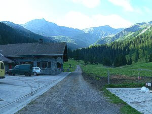
Early morning approach to Valüna.
Arriving in Steg by the Vaduz/Malbun road you must pass through a tunnel, shortly after there is a parking area for hikers on the left hand side. Leave your car here, cross the river via the bridge opposite and take the left hand turn immediately after, the single track road is sign posted for the Seeblick Restaurant. Follow this track up river, past the dam wall and reservoir to a parking area in front of the aforementioned restaurant (you may risk parking here instead). Continue on a good track signposted Valüna and Pfälzerhütte. The track heads southwards following the course of the river which is crossed once before arriving at the Valüna dairy a little over 3Km after leaving Steg (refreshments available). Continue southwards on the track, ignoring any signs that might offer a short cut to the Pfälzerhütte (you do not want to end up there).
|
|
|
Route 1: Steg - Valüna - Valüna Obersass - Col - Hinter Graupsitz - Grauspitzsattel - Vorder Grauspitz.
|
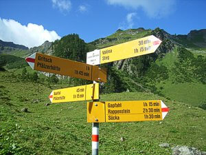
Bright yellow sign posts will help you during the earlier stages of the journey.
1.2Km after leaving Valüna your will arrive at a junction. The left hand track is signposted to Valüna Obersass and the Pfälzerhütte, whilst the right hand is signed to Grapfahl and Rappenstein. Take the left hand track and follow it as it begins to climb steeply in a series of curves to Valüna Obersass. Valüna Obersass has a water trough and signpost, and it is here that you must leave the track and get your boots dirty for the first time. Rather than follow the track as it curves towards the east, you must follow a faint path southwards, up and through a gate in the fence and join the broad footpath that forms part of Liechtensteiner Panoramaweg 66, between Grapfahl, Rappenstein, Alpelti and Sucka to the south and the Pfälzerhütte to the east. Follow the foot path for about thirty metres, before arriving at another junction. Here Liechtensteiner Panoramaweg 66 turns sharply left to the Pfälzerhütte, its course marked by red and white painted stripes on the rocks. Don't take this path. Instead continue on the unmarked path ahead of you, keeping the stream down in the valley floor to your right. 270m later, and you will pass at a bath tub now functioning as a water trough. The path will have narrowed, but continue on upwards, keeping to the high ground with the stream down to your right. The path is easily lost here as it twists up the edge of the cutting dug out by the melt waters, but don't worry, you will soon pick it up again, and as long as stream remains close by on your right hand side you cannot get lost. Continue through the pastures, there are likely to be cattle here (their bells can be heard a great distance away), and pass through the fence on a now reformed path up the banks of moraine with the screes and warpped cliffs of Naafkopf ahead to your left and the peak of Hinter Grauspitz, aka the Schwarzhorn, ahead of you the your right. As the ridge is gained, the slope will steepen, the final dozen metres being particularly slippery, and it is with some relief that a new skyline opens up in front of you. Take good note of the concrete border post with the number 52 painted upon it, should the weather turn bad, this makes a good marker as to where to come down from the ridge on the descent.
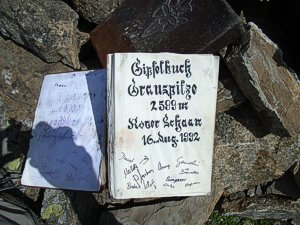
Vorder Grausptitz Summit Book.
At the concrete border post, turn right (south west) along the ridge, where some easy scrambling will bring up onto a faint path, follow that path for around 600m to where a small statue of the Madonna stands close to the old wooden cross just below the summit of Hinter Grauspitz. The Modonna acts as a memorial to one Cordula Vogt (1962 to 1983). Here the path snakes up to the summit of Hinter Grausptz (2574m), and you may choose to visit the top, sit on the bench beneath the cross and admire the views. As well as seeing where you have come from, you should also see the day's target, Vorder Grauspitz, a few hundred meters away to the west with only the Grauspitzsattel ('sattel' is German for Saddle) between you it. However what is stopping you from following the line of sight is a steep and exposed 70m worth of descent down broken and crumbling rocks. Better to turn round and head back to the statue of the Madonna. Here there is a spur that runs southwards to Sunnespitz, follow the spur for about 160m before turning right and crossing the steep slopes to the Grauspitzsattel. Picking the right route here is going to be a personal desision; some may wish to descend further down the spur than others. Rather than a risk of a long fall, the real danger here is to ones' ankles, so sturdy footwear is advised. Gain the Grauspitzsattel and then follow the ridge once more westward and upwards to the summit of Vorder Grauspitz. There is no cross here, but a piles of rocks erected into a cairn. Amongst the rocks you will find a logbook. Return the way you came or via route 2.
Route 2 : Malans Cable Car - Alpibahn Station - Flascher Alp- Sunnespitz Ridge Tunnel - Ljes Alp - Vorder Grauspitz.
Ascent : 1100m
Distance : 19Km return trip
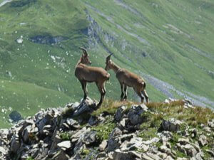
Look out for Ibex.
Ride the cable car from the village of Malans to the top Alpibahn station. Follow the track signposted Kamm and Falknis to the Kamm pass, (beneath the peaks of the Glegghorn to the north and Kamm to the southeast). Shortly after, a footpath takes to the higher ground on the left whilst, the track heads on to Flascher Alp before climbing again, joining the footpath and entering a 250m tunnel through the Sunnespitz Ridge (torch desirable). Shortly after exiting the tunnel, the track turns north and arrives at Ljes Alp. Head west across country into the mouth of the valley before turning northwest up the centre of the spur, following it northwards, then west again to meet with the ridge that connects Hinter Grauspitz with the Sunnespitz. Descend onto the red screes of the Schafalpli hanging valley before climbing up to the Grauspitzsattel and on toward the summit of Vorder Grauspitz.
From Ljes Alp it looks feasible to be able to ascend up onto the ridge and join route 1 at the col "Ljesfűrggli" with boundary post 52, or head direct to Hinter Grauspitz.
|
|
|
Route 2: Malans Cable Car - Alpibahn Station - Flascher Alp- Sunnespitz Ridge Tunnel - Ljes Alp - Vorder Grauspitz.
|
Maps and Books :
|
|
|
OpenStreetMaps shows the ascent routes.
|

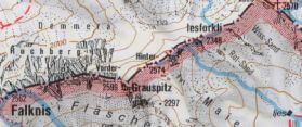 Kompass
 produce a 1:50,000 entitled "Feldkirch - Vaduz" which covers the area in sufficient detail for an attempt on the Grauspitz. A more expensive 1:25,000 map provides more detail, but is not entirely necessary.
 Early morning approach to Valüna.
 Bright yellow sign posts will help you during the earlier stages of the journey.
 Vorder Grausptitz Summit Book.
 Look out for Ibex.

 Kompass produce a 1:50,000 entitled "Feldkirch - Vaduz" which covers the area in sufficient detail for an attempt on the Grauspitz. A more expensive 1:25,000 map provides more detail, but is not entirely necessary.
