ESC -
Bulgaria - Musala (Мусала)
, 2925m - InfoIntroduction:
Musala (Мусала), Bulgaria’s highest summit, is located in the Rila (Рила) Mountains ~100Km south of the country’s capital city, Sofia. The name Musala is said derived from the Islamic “Mountain” or “Throne of Allah”, though it has also been known as “Tangra” during the pre-Islamic Christian era, and “Stalin” between 1949 and 1962 after Joseph Stalin. The communist regime actively encouraged its citizens to exercise in the outdoors, building a network of hiking trails and mountain huts or “hizha” all over the country’s impressive landscape for both the Bulgarians and their soviet neighbours. However it was not until 1992 that the Musala and its neighbours were given a protects status by the formation of the Rila National Park. The name Rila is believed to be of ancient Thracian origin and meaning “well watered”. This belief may well be true as Musala is one of the coldest and wettest places in Bulgaria and is surrounded by many glacial lakes, the latter of which can make a pleasurable tour.
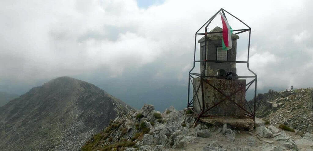
|
| Musala's summit. |
Routes :
The easiest option to gain the summit of Musala is to take the cable car from Borovets to the summit of Yastrebets (2369m), and then slowly descend to the Musala Hut complex on the shore of Musalenski Ezero, and continue up from there as described in the route description below.
Those looking to do all the leg work themselves can walk up from Borovets to the Musala Hut complex, and this is ideal if you arrive in Borovets during the early afternoon and which to spend a cheap night at the Musala Hut.
| The route from Borovets to Musala. |
Starting in Borovets at the road junction outside the Samokov Hotel, follow the road south west for 1.3Km, where a forestry track leaves the road just before it turns to the right. You will have passed under the cable car around half way, and the forestry track is sign posted for the Musala Hut.
Shortly after entering the forest, you will cross a rocky stream, and you will be crossing it a few times before the Musala Hut is reached. You may ether follow the forest track, or take advantage of the way marked foot paths that cut across the corners of the rutted track way. Having followed the forest track for around 2.5Km you will pass Mihalev Kamak, a large bolder on the right hand side of the track with various messages painted upon it. Continue along the track for another 1Km and the track crosses the steam once again. This time with a picnic table set amongst dwarf pine on the eastern bank.
Continue along the track for just under another kilometre and just before reaching a ford, the way marked foot path to the Musala Hut heads off on the left hand side in a due south direction. Follow the path, sometimes over grown, through the dwarf pine, fording the stream a final time until almost 3Km later you will arrive at the Musala Hut complex.
Musala Hut to Ledeno Ezero Hut (2Km, 400m ascent, 1hr 30 mins to 2hrs):
From the Musala Hut, follow the path around the western shore of Musalenski Ezero, i.e. beneath the new hut under construction, and follow the well marked and clearly defined path up past various lakes to the Everest ’84 aka Ledeno Ezero Hut, on the shore of Ledeno Ezero (ice lake).
Ledeno Ezero Hut to Summit (1Km, 175m ascent, 45min to 1 hr):
From the Ledeno Ezero Hut, follow the way marked path sometimes indistinct, up the spur on to the main north ridge. Once on the ridge follow the path as it zig-zags either side of the ridge until the summit is reached. No real difficulties or dangerous moves. In many place the route is also marked by painted poles, but these tend to stick to the crest of the summit ridge which offers an alternative scramble.
Getting there and away :
The standard route up to the summit of Musala begins from the resort of Borovets (Боровец), and one can either find accommodation there or in the town of Samokov (Самоков), a 20 minute road journey from the north. Samokov is serviced by an hour long bus journey from Sofia’s South Bus Station (Avtogara Yug). Arriving here by taxi, one might be concerned that you are being taken the long way round, as the south bus station is situated in a back street area of housing, redevelopments, and under a flyover. Coaches and Mini Buses leave the South Bus Station frequently throughout the day from bay 1 (next to the ticket office), and in 2008 cost 15 Bulgarian Lev (~£7.00 GBP, €6 Euro). Tickets can be purchased on board the bus.
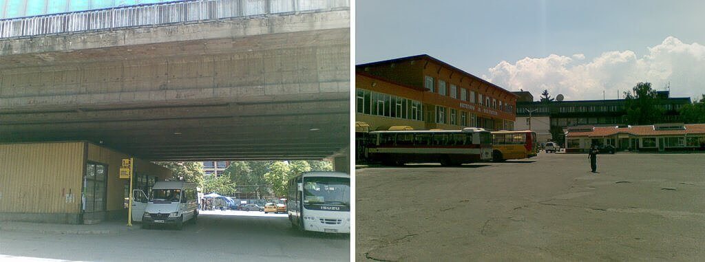
|
| Avtogara Yug (left) and Avtogara Samokov (right) |
Minibuses to Borovets leave from Samokov's more modern bus station every few hours from bay (sektor) 1 located near the stations exit. Again tickets can be purchased on board for 2 lev (~£0.90 GBP, €1 Euro). The return bus to Sofia leaves from bay 6.
Those arriving by air should do so at Sofia’s International Airport. This airport has many international connections, including routes operated by the budget airline industry. From the airport it is probably easiest to take a taxi to Sofia’s south bus station (15 – 20mins) as there appears to be no one stop route provided by Sofia’s public transport system.
Those arriving by train will do so at Sofia Central Station and will need to find their way to the city’s south bus station (Avtogara Yug), not the central bus station (Tsentralna avtogara Sofiya, Централна автогара София) built in 2004 and located adjacent. The easiest way to do this is by taxi, as like from the airport there is no one stop connection. The website of Bulgarian State Railways can be found at www.bdz.bg.
Those wishing to use the public transport system in Sofia should purchase tickets from a kiosk or a stand at the bus stop or from the driver. The ticket must be validated as soon as you board the vehicle in one of the punching devices mounted onto its walls.
Accommodation :
A web search will reveal a wide range of accommodation is available in both Borovets and Samokov. The site www.guide-bulgaria.com appears to be a good place to start, and includes mountain hut listings. Having not stayed at any hotels in Borovets nor Samokov, I cannot recommend from personal experience, but other have recommended the Family Hotel Zodiac and House Djambazki, both in Samokov.
Mountain Huts: There are three mountain huts or “hizha” along the normal summit route;
1. The Hizha Musala (2430m) consists of a group of buildings, the first built in 1924, with others having been constructed, burnt down and rebuilt. In 1966 the Bulgarian Tourist Association built a plain wooden two story building. Dispite new building work commencing in 1986, it is the 1966 hut that was still in use in 2008. The building has a canteen and small shop, and overnight accommodation for 68 people. There is no bathroom, and water is only available outside. Power is supplied from its own Hydroelectric plant, and heating from wood fire stoves. Telephone 0896/71 52 05 and 0896/71 54 15.
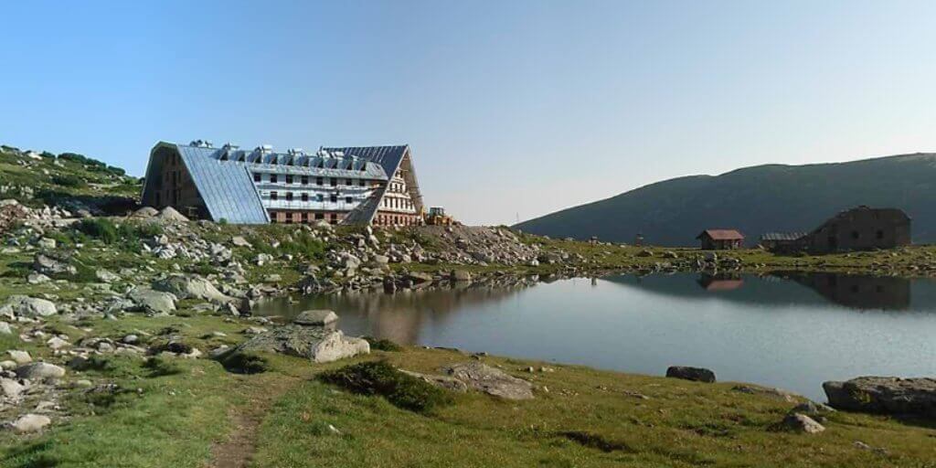
|
| The new Hizha Musala on the shore of Musala Ezero under construction 2008. |
2. The Ledenoto Ezero Hut (aka Everest 84 hut (Еверест)) is a prefabricated wooden hut (faced with sheet metal) on the North West shore of the Ledeno Ezero "Ice Lake" at 2709m. It sleeps 30 but does not supply food, only soft drinks and beer. The drinking water is a 2-3 minute walk from the shelter, and is taken from the lake’s outflow.
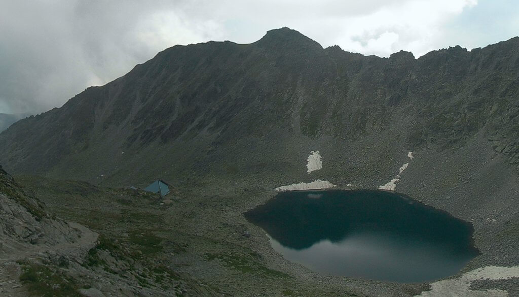
|
| Ledeno Ezero with the Everest '84 Hut to the left, 2008. |
3. The Musala Summit Hut offers liquid refreshment at high season.
Other mountain huts in the area:
Four hours to the south of Musala is the Granchar Hut (Грънчар), a two storey building with 65 places (with outbuildings that take another 155) on the shores Grancher Lake at 2110m. There is a water supply and electricity from its own hydro-electric power station. Heating is from a wood fire stove, there is a bathroom, kitchen and canteen as well as a small shop. Contact by mobile phone on 048/81 14 02 or 048/81 63 17. Email [email protected]. The hut is also connected to the town of Yakoruda by narrow gauge railway.
Camping: Camping is prohibited in the National Park.
Maps and Books :
| OpenStreetMaps shows the ascent routes. |
 Kartografia EOOD Sofia published a map 1:55,000 map of the Rila National Park, though be aware that names and other text (with exception of heights) are printed in Cyrillic. Copies of these maps have found there way on-line at travel.valek.net and SummitPost.
 In 2006, Domino published a1:50,000 map of the Rila Mountains which has both Latin and Cyrillic script. I was able to purchase a copy of this map on my arrival in Borovets. It was widely available in many stores. Contours are every 50m, and was a great help.
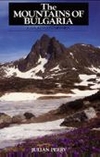 Cordee publishes "The Mountains of Bulgaria, a walker's companion" by Julian Perry, 1995. This appears to be the few English language guide book on the subject, and whilst useful, does not provide any guidance specific to Musala, instead concentration on the E4 European Long Distance Trail that passes through the Rila Mountains to the west. You might well find it useful in providing guidance if staying on in the area.
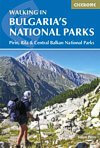 Likewise Cicerone Press published "Walking in Bulgaria's National Parks" also by Julian Perry, 2017. This appears not to cover Musala either.
Useful Links :
Bulgarian travel information can be found at www.discover-bulgaria.com.
Another usefull site is that of the Bulgarian mountain walker www.planinite.info.
You can read the latest UK government travel advise to Bulgeria at www.gov.uk/foreign-travel-advice/bulgaria.
For a weather forecast, check www.mountain-forecast.com.
