ESC -
Bosnia and Herzegovina - Maglić
, 2386m - Info | VR TourIntroduction :
Maglić is located in the The Sutjeska National Park about 20 km southwest of the town of Foca, on the very border of Bosnia with Montenegro. All hillsides, except north-western, are very steep and overgrown with coniferous and beech forest. The tree line is at approximately 1600m, above this is a plateau with excellent pastures. Many summits and ridges rise from the plateau.
The area is reportedly clear of the land mines that hinder access to many other parts of the Bosnian countryside.
Routes :
Most routes to the roof of Bosnia start from the trail head at Prijevor. When I visited in 2011 the road from Tjentiste to Prijevor was in very poor condition and grounding or damage to the underside of the car was a very real possibility. The road may have been resurfaced since then.
Option 1: Prijevor to Maglić direct
Distance: 2.2km
Ascent: 720m
| Option 1: Prijevor to Maglić direct. |
Suffice to say the route is almost in a direct line from Prijevor to the summit, and after some initial comfortable walking climbs the north face of Maglić. Here the route becomes steep and the rock loose. The waymarked path follows narrow ledges and in many places protected by sections of wire cable.
Option 2: Prijevor to Maglić via Trnovaćko jezero
Distance: 10km
Ascent: 1200m
| Option 2: Prijevor to Maglić via Trnovaćko jezero. |
From Prijevor follow the broad track southwards, crossing into Montenegro after around 2Km. There is no physical sign of the border. Shortly after the track loops round to the left, whilst the waymarked path forks off to the right re-joining the track a little later. Stay on the path for around 250m before peeling off to the right once again, following the waymarked path down into the valley of the dry lake. Cross the meadow on the matrix of paths before entering the forest at the southern end. Climb steadily on the forest paths to Trnovaćko jezero (Trnovaćko lake). The lake is a beautiful place to rest, and perhaps camp. Follow the path around the lake's western and southern shore. Heading east, the path now enters woodland and begins to climb once again, weaving up between crags and then breaking out onto grass covered slopes. Follow the path up these slopes, heading roughly north east. Cross the steep scree covered slope (with great views down to Trnovaćko jezero) before passing between two rock pillars on to the high plateau above the sunken hollow of Carev do. Here one follows the ridge northwards, reaching the summit of Maglić after passing a few minor tops. VR Tour
 © D. Stillingfleet")
|
| Looking down on Trnovaćko jezero (Lake Trnovaćko). |
Option 3: Dernicista to Maglić
Distance: 5km
Ascent: 750m
| Option 3: Dernicista to Maglić. |
Follow the waymarkings southwards, following the forestry track, but looking out for where the path branches off to the right. After around 1.7Km, the path breaks out from the forest and weaves between meadows and dwarf pine. The dwarf pines thin out, and the walk along the grassy hillside is utterly beautiful (at least in the sunshine). As you progress the white cliffs of Maglić come into sight. But rather than heading straight for the summit, the path takes you further south, looking for a way to penetrate the formidable barrier. After a short gentle descent, the trail climbs first up a grassy gully, then continues south traversing the steep mountainside. There is a short steep climb guarded by iron rope, and another traverse into a narrow scree gully. Here the path climbs directly upwards and it is with some relief that you reach the grass covered slopes again. But there is no letting up on the gradient, the path continues to climb steeply, eventually topping out on the ridge south of Maglić's summit. Follow the path northwards before reaching the final scramble to the grass covered summit. VR Tour

|
| Maglić from col on the ridge. |
Getting there and away :
From Sarajevo (Bosnia's capital) or from one of the holiday resorts on the Croatian coast head to the city of Foca. Allow plenty of time for this. The roads pass through high mountains and are long and winding. Do not expect dual carriageways. Shortly before arriving in Foca, take the road south towards the town of Tjentiste. Just before entering Tjentiste, there is a narrow road on the left, that leads off toward a parking / picnic area from where trail markings show the way to Maglic.
Accommodation :
Hotels: Hotel “Mladost” is located at Tjentiste and offers good value for money. I could not find it's own website, but it is listed on the normal hotel booking websites.
Mountain Huts: "Kutan" (in the local language) located at Prijevor are available for hire through the national park.
Camping: It's unclear if wild camping is permitted.
Maps and Books :
| OpenStreetMaps shows the ascent routes. |
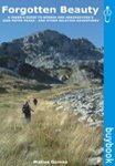 Seek out Forgotten Beauty, A Hiker's Guide to Bosnia and Herzegovina's 2000 Metre Peaks - and Other Selected Adventures by Matias Gomez published by Buybook in March 2005, ISBN 9958630591. This book includes background information, route descriptions, and map.
Useful Links :
www.bhtourism.ba is the official tourist website and is targeting the country to those who love the outdoors.
The National Park Sutjeska Website has great local information, hotels, restaurants, hiking etc.
You can read the latest UK government travel advise to Bosnia at www.gov.uk/foreign-travel-advice/bosnia-and-herzegovina.
For a weather forecast, check www.mountain-forecast.com.